Kawartha Lakes (Ontario)

In diesem Artikel oder Abschnitt fehlen noch folgende wichtige Informationen:
Geschichte, Klima, Geografie, Wirtschaft, Persönlichkeiten etc.
Hilf der Wikipedia, indem du sie recherchierst und einfügst.
| Kawartha Lakes | |||
|---|---|---|---|
 Lindsay | |||
| Motto: Catch the Kawartha Spirit | |||
| Lage in Ontario | |||
| |||
| Staat: | Kanada Kanada Kanada | ||
| Provinz: | Ontario | ||
| Koordinaten: | 44° 21′ N, 78° 45′ W44.35-78.75Koordinaten: 44° 21′ N, 78° 45′ W | ||
| Fläche: | 3 084,38 km² | ||
| Einwohner: | 75.423 (Stand: 2016[1]) | ||
| Bevölkerungsdichte: | 24,5 Einw./km² | ||
| Zeitzone: | Eastern Time (UTC−5) | ||
| Bürgermeister: | Ric McGee | ||
| Website: | www.city.kawarthalakes.on.ca | ||
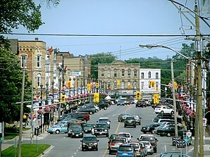
 Kawartha Lakes Rathaus | |||


Kawartha Lakes (offiziell „City of Kawartha Lakes“) ist eine Gemeinde im Südosten der kanadischen Provinz Ontario mit etwa 75.000 Einwohnern. Sie hat den Status einer single-tier municipality (einstufigen Gemeinde).[2]
Die Gemeinde liegt an den westlichen Seen der namensgebenden Seengruppe, am nördlichen Rand des Golden Horseshoe (Goldenes Hufeisen) bzw. in den südlichen Ausläufern des kanadischen Schildes. Im südlichen Bereich wird sie von der Hügelkette der Oak Ridges-Moräne durchzogen.
Gliederung
Die „City of Kawartha Lakes“ ist, trotz des Namens, von überwiegend ländlicher Struktur. Wesentliche Siedlungspunkte (Villages innerhalb der Stadt) sind:
- Argyle
- Avery Point
- Baddow
- Baker Trail
- Bellevue
- Bethel
- Daytonia Beach
- Feir Mill
- Hartley
- Lindsay (Town, Sitz der Verwaltung)
- Long Point
- Woodville
Bevölkerungsentwicklung
Die Bevölkerung von Kawartha Lakes hat von Mitte der 1990er Jahre bis Mitte der 2000er Jahre zugenommen und sich seitdem nicht mehr stark verändert. In der folgenden Tabelle sind die Einwohnerzahlen in den Jahren des jeweils durchgeführten Zensus aufgeführt:[3][4]
| Jahr | Einwohner |
|---|---|
| 1996 | 67.926 |
| 2001 | 69.179 |
| 2006 | 74.561 |
| 2011 | 73.219 |
| 2016 | 75.423 |
Weblinks
Commons: Kawartha Lakes – Sammlung von Bildern
Einzelnachweise
- ↑ Statistics Canada: Census Profile, 2016 Census – Kawartha Lakes, City (Census subdivision), Ontario and Ontario (Province), abgerufen am 19. Mai 2021
- ↑ List of municipalities. Ontario Ministry of Municipal Affairs and Housing, 11. Mai 2021, abgerufen am 3. Juni 2021 (englisch).
- ↑ Statistics Canada: Census Profile, 2011 Census – Kawartha Lakes, City (Census subdivision), Ontario and Ontario (Province), abgerufen am 19. Mai 2021
- ↑ Statistics Canada: Census Profile, 2001 Census – Kawartha Lakes, City (Census subdivision), Ontario and Ontario (Province), abgerufen am 19. Mai 2021

Einstufige Gemeinden: Brant | Brantford | Chatham-Kent | Greater Sudbury | Haldimand | Hamilton | Kawartha Lakes | Norfolk | Ottawa | Prince Edward | Toronto
Regionalgemeinden: Durham | Halton | Muskoka | Niagara | Oxford | Peel | Waterloo | York
Countys: Bruce | Dufferin | Elgin | Essex | Frontenac | Grey | Haliburton | Hastings | Huron | Lambton | Lanark | Leeds and Grenville | Lennox and Addington | Middlesex | Northumberland | Perth | Peterborough | Prescott and Russell | Renfrew | Simcoe | Stormont, Dundas and Glengarry | Wellington
Distrikte: Algoma | Cochrane | Kenora | Manitoulin | Nipissing | Parry Sound | Rainy River | Sudbury | Thunder Bay | Timiskaming


