Île-à-la-Crosse 192E
Indian reserve in Saskatchewan, Canada
Indian reserve in Canada, English River
Île-à-la-Crosse 192E | |
|---|---|
Indian reserve | |
| Île-à-la-Crosse Indian Reserve No. 192E | |
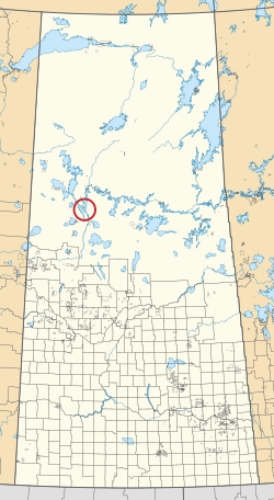 Location in Saskatchewan | |
| First Nation | English River |
| Country | Canada |
| Province | Saskatchewan |
| Area | |
| • Total | 6 ha (15 acres) |
Île-à-la-Crosse 192E is an Indian reserve of the English River First Nation in Saskatchewan.[1][2] It is 5 miles (8.0 km) eastern of Île-à-la-Crosse, on the east shore of Lac Île-à-la-Crosse, Township 74, Range 12, west of the Third Meridian. It is at the mouth of the Beaver River.
See also
References
- ^ a b "Reserve/Settlement/Village Detail". Crown–Indigenous Relations and Northern Affairs Canada. Government of Canada. Retrieved 12 August 2019.
- ^ "Canada Lands Survey System - CLSS Map Browser". Natural Resources Canada. Retrieved 9 October 2019.
- v
- t
- e
band governments
| Agency Chiefs Tribal Council (Spiritwood) | |
|---|---|
| Battlefords Agency Tribal Chiefs (North Battleford) | |
| Battlefords Tribal Council (North Battleford) | |
| File Hills Qu'Appelle Tribal Council (Fort Qu'Appelle) | |
| Meadow Lake Tribal Council (Meadow Lake) | |
| Prince Albert Grand Council (Prince Albert) | |
| Saskatoon Tribal Council (Saskatoon) | |
| Touchwood Agency Tribal Council (Punnichy) | |
| Yorkton Tribal Administration (Yorkton) | |
| Unaffiliated | |
| Not federally recognized |

55°27′21″N 107°46′26″W / 55.4559°N 107.7739°W / 55.4559; -107.7739 (Île-à-la-Crosse 192E)
 | This article about a location in the Census Division No. 18 of Saskatchewan is a stub. You can help Wikipedia by expanding it. |
- v
- t
- e
 | This article about an Indian reserve in Saskatchewan is a stub. You can help Wikipedia by expanding it. |
- v
- t
- e


