Abraham Allard
Dutch map engraver (1676–1725)
- Carel Allard

Abraham Allard (8 January 1676, Amsterdam - 26 January 1725, Amsterdam) was a Dutch map engraver active in Amsterdam.[1]
Maps
-
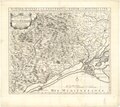
 Map Duchy of Brabant (c. 1750) by Abraham Allard, published in Amsterdam by Johannes Covens (1720-1772) and Cornelis Mortier (1720-1772).
 -
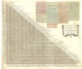 Steden distancie meet tafel van Nederland, tot Paris toe (c. 1710) by Abraham Allard.
 -
 Les Bas Sevennes, dans le Languedoc ou Le diocese de Montpellier (c. 1700) by Abraham Allard.


References
- ^ "Abraham Allard". ECARTICO - Linking cultural industries in the early modern Low Countries, ca. 1475 - ca. 1725. Retrieved 2021-04-05.
External links
- http://www.biografischportaal.nl/persoon/56255294
- http://data.bnf.fr/14968917/abraham_allard/
- http://www.npg.org.uk/collections/search/person/mp91445/abraham-allard
Authority control databases | |
|---|---|
| International |
|
| National |
|
| Artists |
|
| People |
|


