Ashotavan
Place in Syunik, Armenia
Ashotavan Աշոտավան | |
|---|---|
 | |
39°28′35″N 45°59′52″E / 39.47639°N 45.99778°E / 39.47639; 45.99778 | |
| Country | Armenia |
| Province | Syunik |
| Municipality | Sisian |
| Area | |
| • Total | 17.16 km2 (6.63 sq mi) |
| Population (2011) | |
| • Total | 589 |
| • Density | 34/km2 (89/sq mi) |
| Time zone | UTC+4 (AMT) |
| Ashotavan at GEOnet Names Server | |
Ashotavan (Armenian: Աշոտավան) is a village in the Sisian Municipality of the Syunik Province in Armenia.
Etymology
The village was previously known as Aghk’end, T’azak’end, Khnok and Kirakosik.
Demographics
The Statistical Committee of Armenia reported its population as 647 in 2010,[2] up from 623 at the 2001 census.[3]
Gallery
-
 Scenery
 -
 River
River -
 Scenery
 -
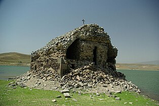
 Church
 -
 Church


References
Wikimedia Commons has media related to Ashotavan.
- ^ "Syunik regional e-Governance System" (in Armenian). Syunik Province provincial government. Click on link entitled "Համայնքներ" (community) and search for the place by Armenian name.
- ^ "Marzes of Armenia and Yerevan City in Figures, 2010" (PDF). Statistical Committee of Armenia.
- ^ Report of the results of the 2001 Armenian Census, Statistical Committee of Armenia
- v
- t
- e
 Syunik Province
Capital: Kapan

- Achanan
- Agarak
- Aghvani
- Antarashat
- Arajadzor
- Artsvanik
- Bargushat
- Chakaten
- Chapni
- Davit Bek
- Ditsmayri
- Dzorastan
- Geghanush
- Gomaran
- Kaghnut
- Khdrants
- Khordzor
- Nerkin Hand
- Nerkin Khotanan
- Norashenik
- Okhtar
- Sevakar
- Shikahogh
- Shishkert
- Shrvenants
- Srashen
- Syunik
- Sznak
- Tandzaver
- Tavrus
- Tsav
- Uzhanis
- Vanek
- Vardavank
- Verin Khotanan
- Yegheg
- Yeghvard
- Erkenants [hy]
Portal:
 Geography

 | This article about a location in Syunik Province, Armenia is a stub. You can help Wikipedia by expanding it. |
- v
- t
- e


