Barra del Chuy
Resort in Rocha Department, Uruguay
33°45′20″S 53°23′20″W / 33.75556°S 53.38889°W / -33.75556; -53.38889 Uruguay
 (2011)
27102
Barra del Chuy is a resort (balneario) in the Rocha Department of southeastern Uruguay. Its name means Mouth of Chui (stream). It is the last coastal resort of Uruguay, bordering Brazil to the southeast with the stream Arroyo Chui as the natural border.
Geography
The resort is located on the coast of the Atlantic Ocean, 8 kilometres (5.0 mi) in a southeastern direction into a road that spits from Route 9 about 6 kilometres (4 mi) before Chuy. It borders the resort Puimayen to the southwest.
History
In the summer of 1994, the yellow cold-water clams on a 21-kilometre (13 mi) stretch of beach near the town experienced a massive die-off due to the warming waters in the South Atlantic blob, a hot spot of 340,000 km2 (130,000 sq mi) of ocean which has warmed 2 °C (4 °F) over the last century.[1]
Population
In 2011 Barra del Chuy had a population of 370 permanent inhabitants and 1,021 dwellings.[2]
| Year | Population | Dwellings |
|---|---|---|
| 1963 | 83 | 225 |
| 1975 | 145 | 475 |
| 1985 | 275 | 563 |
| 1996 | 312 | 671 |
| 2004 | 367 | 869 |
| 2011 | 370 | 1,021 |
Source: Instituto Nacional de Estadística de Uruguay[3]
References
- ^ Mooney, Chris; Muyskens, John (September 11, 2019). "Dangerous new hot zones are spreading around the world". The Washington Post. Archived from the original on 2019-09-11. Retrieved 2019-12-03.
- ^ "Censos 2011 Rocha (needs flash plugin)". INE. 2012. Archived from the original on 11 November 2012. Retrieved 30 August 2012.
- ^ "1963–1996 Statistics / B" (DOC). Instituto Nacional de Estadística de Uruguay. 2004. Archived from the original on 21 July 2011. Retrieved 29 July 2011.
External links
- INE map of Barra del Chuy and Puimayen
- Tourist information for Barra del Chuy
- Main Portal Barra del Chuy
- Brief history of the resort
- v
- t
- e
 Coast of Rocha
and
Landforms
- Laguna Garzón
- Playa San Sebastian
- El Caracol
- Costa Bonita
- Santa Rita
- Las Garzas
-
- Laguna de Rocha
- Rincon de la Laguna
- La Paloma
- Los Botes
- Anaconda
- Radar
- Parroquia
- Apostadero Naval
- La Aguada y Costa Azul
- & Pinares de Costa Azul
- La Cuchilla
- Arachania
- & Diamante de la Pedrera
- La Pedrera
- Pta.Rubia y Sta.Isabel de la Pedrera
-
- San Antonio
- Mar del Plata
- Santa Maria del Pinar
- El Palenque
- San Francisco
- Brisas del Este
-
- San Bernardo
- Valizas
- Puerta del Sol
- Atlantica
- La Florida
- San Remo
- Oceania
-
- Pinares
- Costa Rica
- Los Palmares
- Brisas del Polonio
- Perla de Rocha
- Costa de Oro
- Cabo Polonio
- Roca del Polonio
- Calavera
-
- Pta Castillos Grande
- Pta Aguada
- Cabo Castillos
- Pta del Marco
- Barra de Valizas
- Fondos de Valizas
- Aguas Dulces
- La Esmeralda
-
- Las Sirenas
- Pta Palmar
- Punta del Diablo
- Santa Teresa National Park
- Cerro Derivero
- Playa Grande
- Pta del Barco
- Playa del Barco
- Campamentos
- Pta Cerro Chato
- Pta de la Moza
- Playa de la Moza
-
- Pta de los Loberos
- Pta de la Coronilla
- La Coronilla
- & Country Club
- Palmares de la Coronilla
- & Atalaya
- Playa del Este
- Yodosal
- Puimayen
- & Samuel
- Barra del Chuy
- Glossary
- Barra = Mouth (of river)
- Cabo = Cape
- Cerro = Hill
- Costa = Coast
- Laguna = Lagoon
- Playa = Beach
- Puerto = Port
- Punta (or Pta) = Point, Small Peninsula
- Rincón = Nook, Retreat
- Roca = Rock
| ||
|---|---|---|
Capital: Rocha | ||
| Towns and villages | 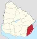 | |
| Sights |
| |
 | This article about a place in Rocha Department is a stub. You can help Wikipedia by expanding it. |
- v
- t
- e


