Cerro del Vigía
Foothill in Ponce, Puerto Rico

Cerro del Vigía
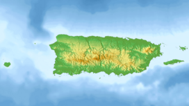
Location in Puerto Rico
Cerro del Vigía[a] is a hill in the municipality of Ponce, Puerto Rico, located just north of the city of Ponce. A tourist destination, it is home to Museo Castillo Serrallés, Cruceta del Vigía, and the former Hotel Ponce Intercontinental.
The 456-foot high hill sits at the foothills of the Cordillera Central and is located in Barrio Portugués Urbano.[4][5][6] The hill is home to several well-to-do mansions of which the best known is Castillo Serrallés, now a Museum.
Location and geology
The hill is part of the Cordillera Central and is located just north of Barrio Segundo in the urban zone of Ponce.[7] It is located at coordinates 18° 01' 08", -66° 37' 13". Just west of Cerro del Vigía is Ponce Cement, as the hills in this area are mostly limestone.
Best view
The view from atop Cerro del Vigía is said to be "the best view in all of Ponce". On a clear day, it is possible to see clearly all the way to Caja de Muertos. There is a 100-feet observation cross at the top of the hill from where the entire zone can be observed. The best road for access to the top of the hill is Calle Bertoly.
See also
 Puerto Rico portal

Notes
- ^ Some sources call this hill "Cerro El Vigía". Here we use the much older --and yet currently in continued widespread use-- "Cerro del Vigía", in part because it works as a reminder as to the history of the hill (i.e., the hill of the watchman) and in part because it is the name found in the oldest map of the hill known to exist. Said map is dated 1818 and was first published by Eduardo Neumann Gandía in "Verdadera y Auténtica Historia de la Ciudad de Ponce: desde sus primitivos tiempos hasta la época contemporánea", in 1913, pages 65-66. (Reprinted in 1987 in San Juan, P.R. by Instituto de Cultura Puertorriqueña.)
References
- ^ "Feature Detail Report for: Cerro el Vigia". U.S. Geological Survey. 1 January 2000. Retrieved 20 January 2019.
- ^ "Feature Detail Report for: Cerro el Vigia". U.S. Geological Survey. 1 January 2000. Retrieved 20 January 2019.
- ^ "Cerro del Vigía". Geographic Names Information System. United States Geological Survey, United States Department of the Interior. Retrieved 20 January 2019.
- ^ Government of the Commonwealth of Puerto Rico. Office of Management and Budgeting. Government Information and Technology Area. Geographic Information Systems Unit. General Purpose Population Data, Census 2000. Archived 2010-08-12 at the Wayback Machine Retrieved 21 March 2010.
- ^ Ponce Topographic Map. Map Styles: Map and Shaded. Trails.com. From: United States Geological Survey. Topo Map. Projection: NAD83/WGS84. Retrieved 22 February 2010.
- ^ Mountainzone.com: Ponce County, Puerto Rico, Mountain Peaks & Summits.
- ^ Nueva Geografía de Puerto Rico: física, económica y social. Rafael Pico. 1975.
- v
- t
- e
- Anón
- Bucaná
- Canas
- Canas Urbano
- Capitanejo
- Cerrillos
- Coto Laurel
- Cuarto
- Guaraguao
- Machuelo Abajo
- Machuelo Arriba
- Magueyes
- Magueyes Urbano
- Maragüez
- Marueño
- Montes Llanos
- Playa
- Portugués
- Portugués Urbano
- Primero
- Quebrada Limón
- Quinto
- Real
- Sabanetas
- San Antón
- San Patricio
- Segundo
- Sexto
- Tercero
- Tibes
- Vayas

- Museo de Arte de Ponce
- Museo Parque de Bombas
- Museo Castillo Serrallés
- Centro Ceremonial Indígena de Tibes
- Museo Hacienda Buena Vista
- Museo Casa Paoli
- Museo de la Masacre de Ponce
- Museo de la Música Puertorriqueña
- Museo del Deporte
- Museo de la Historia de Ponce
- Museo de la Arquitectura Ponceña
- Museo del Autonomismo Puertorriqueño
- Museo Biblioteca RHC
- Panteón Nacional Román Baldorioty de Castro
- Hospital Damas
- Hospital San Lucas
- Hospital Dr. Pila
- Hospital Oncológico Andrés Grillasca
- Hospital San Cristóbal
- Steven Anthony Children's Hospital
- Cardona
- Ratones
- Frío
- Caja de Muertos
- Morrillito
- Gatas
- Jueyes
- Cerro de Punta
- Peñón de Ponce
- Cerro del Vigía
- Cerro del Diablo
- Monte Jayuya
- Cerro Maravilla


