Chietla Municipality
You can help expand this article with text translated from the corresponding article in Spanish. (January 2015) Click [show] for important translation instructions.
- View a machine-translated version of the Spanish article.
- Machine translation, like DeepL or Google Translate, is a useful starting point for translations, but translators must revise errors as necessary and confirm that the translation is accurate, rather than simply copy-pasting machine-translated text into the English Wikipedia.
- Do not translate text that appears unreliable or low-quality. If possible, verify the text with references provided in the foreign-language article.
- You must provide copyright attribution in the edit summary accompanying your translation by providing an interlanguage link to the source of your translation. A model attribution edit summary is
Content in this edit is translated from the existing Spanish Wikipedia article at [[:es:Chietla]]; see its history for attribution. - You may also add the template
{{Translated|es|Chietla}}to the talk page. - For more guidance, see Wikipedia:Translation.
Municipality in Puebla, Mexico

Coat of arms

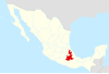
Location of the municipality in Puebla
 Mexico
Chietla Municipality is a municipality in the Mexican state of Puebla in south-eastern Mexico.[1]
References
- ^ "-". Enciclopedia de los Municipios de México. Instituto Nacional para el Federalismo y el Desarrollo Municipal. Archived from the original on April 5, 2007. Retrieved January 4, 2010.
- v
- t
- e

18°31′08″N 98°34′47″W / 18.5189°N 98.5797°W / 18.5189; -98.5797


