Childers Hill, Tennessee
Unincorporated community in Tennessee, United States
35°04′42″N 88°19′30″W / 35.07833°N 88.32500°W / 35.07833; -88.32500 (2020)[2]
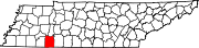
Childers Hill is an unincorporated community in Hardin County, Tennessee. Childers Hill is located south of Savannah and west of the Tennessee River.
Demographics
| Census | Pop. | Note | %± |
|---|---|---|---|
| 2020 | 100 | — | |
| U.S. Decennial Census[4] | |||
References
- ^ "ArcGIS REST Services Directory". United States Census Bureau. Retrieved October 15, 2022.
- ^ "Census Population API". United States Census Bureau. Retrieved October 15, 2022.
- ^ "US Board on Geographic Names". United States Geological Survey. October 25, 2007. Retrieved January 31, 2008.
- ^ "Census of Population and Housing". Census.gov. Retrieved June 4, 2016.
- v
- t
- e
Municipalities and communities of Hardin County, Tennessee, United States
County seat: Savannah
- Childers Hill
- Counce
- Morris Chapel
- Nixon
- Olivet
- Shiloh
- Walnut Grove
communities
‡This populated place also has portions in an adjacent county or counties
- Tennessee portal
- United States portal
 | This Hardin County, Tennessee geography–related article is a stub. You can help Wikipedia by expanding it. |
- v
- t
- e


