Command Ridge
Highest point in Nauru

Command Ridge
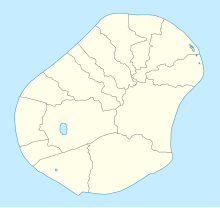
Nauru
Command Ridge is the highest point of Nauru, with an elevation of 65 metres (213 ft).
Passing close to Command Ridge is the boundary between Aiwo and Buada districts.
History
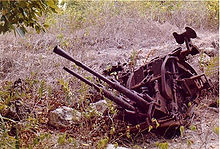
Nauru was once occupied by the Japanese during World War II. Command Ridge contained their communications bunker on Nauru, and some remnants of it remain, including rusted WWII guns/artillery. The bunker itself contains Japanese writing on the walls [2]
See also
- Geography of Nauru
References
- ^ a b c "Nauru High Point" on Peakbagger Retrieved 24 September 2011
- ^ "Command Ridge | Nauru Attractions".
External links
- (in English) Adventure Details: Command Ridge, Topoworld.com.
- (in English) Command Ridge, Lonelyplanet.com
- v
- t
- e


