Devil's Hopyard State Park
State park in Connecticut, United States

Devil's Hopyard State Park is a public recreation area located at the Eightmile River's Chapman Falls in the town of East Haddam, Connecticut. The 1,000-acre (400 ha) state park includes facilities for hiking, fishing, bicycling, picnicking, and camping. It is managed by the Connecticut Department of Energy and Environmental Protection.[3]
History
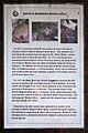
The park was the site of an attack by the Sons of Liberty, in 1775, on a mill owned by pro-British loyalists. After a portion of the broken millstone was found at the foot of the falls in 2002, a park sign (pictured at left) was erected to present details of the story.[4]
The park's falls powered "Beebe's Mills" (named after the original owner) until the 1890s.[3] The site was acquired by the state for use as a state park in 1919 at the prodding of A.G. Willard, a resident of Colchester who had expressed her concern with the extent of logging operations taking place in the area.[5]
Name
At some time prior to 1800, there was a malt house on George Griffin's farm near a small tributary of the Eightmile River called Malt House Brook. The malt house was abandoned prior to 1814, but during the period of its operation Griffin grew hops in a small clearing—the "hopyard"—beside the road running through the area now called Devil's Hopyard.[5]
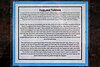
There are a number of theories as to why the area was named “Devil's” Hopyard, ranging from a landowner named Dibble to supernatural explanations for the naturally occurring potholes near the falls. A sign in the park (pictured at left) has more on the legends of the etymology of the park's name.
Attractions
The principal feature of the park, Chapman Falls, drops more than 60 feet (18 m) over a series of steps in a Scotland schist stone formation.[3] The Vista Point cliff, located at the end of the Orange Trail, stands 150 to 175 feet (53 m) above the Eightmile River. Other attractions include "mini falls" and three historic highway bridges listed on the National Register of Historic Places.
In the news
On March 26, 2012, a large brush fire struck the park. Efforts by firefighters from fourteen towns included burning out the area behind two threatened households. The fire consumed more than fifty acres over two days before authorities let it burn itself out. Officials proposed hikers as a possible cause of the blaze. Six to 12 inches of soot, ash and other residue filled the area for some time thereafter.[6][7]
References
- ^ a b "Devil's Hopyard State Park". Geographic Names Information System. United States Geological Survey, United States Department of the Interior.
- ^ "Appendix A: List of State Parks and Forests" (PDF). State Parks and Forests: Funding. Staff Findings and Recommendations. Connecticut General Assembly. January 23, 2014. p. A-1. Retrieved March 20, 2014.
- ^ a b c "Devil's Hopyard State Park". State Parks and Forests. Connecticut Department of Energy and Environmental Protection. July 18, 2016. Retrieved September 15, 2016.
- ^ Bowles, Adam (January 25, 2004). "Uncovering a millstone who-done-it". New York Times. Retrieved June 17, 2013.
- ^ a b "Ask the Courant". Hartford Courant. Hartford, Conn. January 29, 2001. Retrieved June 17, 2013.
- ^ Benson, Judy (March 28, 2012). "Devil's Hopyard State Park charred by fire; trails closed for now". The Day. New London, Conn. Retrieved June 17, 2013.
- ^ W. Smith; L. Dahlem; R. Hanrahan (March 28, 2012). "Dry conditions cause more brush fires". NBC Connecticut. West Hartford, Conn. Retrieved May 17, 2013.
External links
Wikimedia Commons has media related to Devil's Hopyard State Park.
- Devil's Hopyard State Park Connecticut Department of Energy and Environmental Protection
- Devil's Hopyard State Park Map Connecticut Department of Energy and Environmental Protection
- v
- t
- e
Protected areas of Connecticut
- Above All
- Air Line
- Beaver Brook
- Becket Hill State Park Reserve
- Beckley Furnace Industrial Monument
- Bennett's Pond
- Bigelow Hollow
- Black Rock
- Bluff Point
- Bolton Notch
- Brainard Homestead
- Burr Pond
- Camp Columbia
- Campbell Falls
- Chatfield Hollow
- Collis P. Huntington
- Connecticut Valley Railroad
- Dart Island State Park
- Day Pond
- Dennis Hill
- Devil's Hopyard
- Dinosaur
- Eagle Landing
- Farm River
- Farmington Canal
- Fort Griswold Battlefield
- Fort Trumbull
- Gardner Lake
- Gay City
- George Dudley Seymour
- George Waldo
- Gillette Castle
- Haddam Island
- Haddam Meadows
- Haley Farm
- Hammonasset Beach
- Harkness Memorial
- Haystack Mountain
- Higganum Reservoir
- Hop River State Park Trail
- Hopemead
- Hopeville Pond
- Horse Guard
- Housatonic Meadows
- Humaston Brook
- Hurd
- Indian Well
- John A. Minetto
- Kent Falls
- Kettletown
- Killingly Pond
- Lake Waramaug
- Lamentation Mountain
- Larkin State Park Trail
- Lovers Leap
- Macedonia Brook
- Machimoodus
- Mansfield Hollow
- Mashamoquet Brook
- Mianus River
- Millers Pond
- Minnie Island
- Mohawk Mountain
- Mono Pond
- Moosup Valley State Park Trail
- Mooween
- Mount Bushnell
- Mount Riga
- Mount Tom
- Old Furnace
- Osbornedale
- Penwood
- Platt Hill
- Pomeroy
- Putnam Memorial
- Quaddick
- Quinebaug Lake
- Quinnipiac River
- River Highlands
- Rocky Glen
- Rocky Neck
- Ross Pond
- Salt Rock State Campground
- Satan's Kingdom State Recreation Area
- Scantic River
- Selden Neck
- Seth Low Pierrepont
- Sherwood Island
- Silver Sands
- Sleeping Giant
- Southford Falls
- Squantz Pond
- Stillwater Pond
- Stoddard Hill
- Stratton Brook
- Sunnybrook
- Sunrise
- Talcott Mountain
- Tri-Mountain
- Trout Brook Valley
- Wadsworth Falls
- West Rock Ridge
- Wharton Brook
- Whittemore Glen
- Windsor Locks Canal State Park Trail
- Windsor Meadows
- Wooster Mountain
- Algonquin
- American Legion
- Centennial Watershed
- Cockaponset
- Enders
- James L. Goodwin
- Housatonic
- Massacoe
- Mattatuck
- Meshomasic
- Mohawk
- Mohegan
- Nassahegon
- Natchaug
- Nathan Hale
- Naugatuck
- Nehantic
- Nepaug
- Nipmuck
- Nye-Holman
- Pachaug
- Paugnut
- Paugussett
- People's
- Pootatuck
- Quaddick
- Salmon River
- Shenipsit
- Topsmead
- Tunxis
- Wyantenock
- Aldo Leopold WMA
- Assekonk WMA
- Babcock Pond WMA
- Barber Pond WMA
- Barn Island WMA
- Bartlett Brook WMA
- Bear Hill WMA
- Belding WMA
- Bishops Swamp WMA
- Black Pond WMA
- Candlewood Hill WMA
- Cedar Swamp WMA
- Charles E. Wheeler WMA
- Cromwell Meadows WMA
- Durham Meadows WMA
- East River Marsh WMA
- East Swamp WMA
- Eightmile River WMA
- Franklin Swamp WMA
- Goshen WMA
- Great Harbor WMA
- Higganum Meadows WMA
- Housatonic River WMA
- King's Island Coop WMA
- Kollar WMA
- Larson Lot WMA
- Little River Fish and Wildlife Area
- Lord's Cove WMA
- Maromas Coop WMA
- Meadow Brook WMA
- Menunketesuck WMA
- Messerschmidt WMA
- Newgate WMA
- Nod Brook WMA
- Nott Island WMA
- Pease Brook WMA
- Plum Bank WMA
- Quinebaug River WMA
- Quinnipiac River Marsh WMA
- Ragged Rock WMA
- Raymond Brook Marsh WMA
- Robbins Swamp WMA
- Roger Tory Peterson Wildlife Area
- Roraback WMA
- Rose Hill WMA
- Ross Marsh WMA
- Salmon River Cove and Haddam Neck WMA
- Sessions Woods WMA
- Simsbury WMA
- Skiff Mountain Coop WMA
- James V. Spignesi WMA
- Stanley Works WMA
- Suffield WMA
- Talbot WMA
- Tankerhoosen WMA
- Wangunk Meadows WMA
- Wopowog WMA
- Zemko Pond WMA
- Aspetuck Reservoir
- Barkhamsted Reservoir
- Beaver Dam Lake
- Candlewood Lake
- Easton Reservoir
- Far Mill Reservoir
- Hemlock Reservoir
- Hop Brook Lake
- Lake Lillinonah
- Mansfield Hollow Lake
- Means Brook
- Saugatuck Reservoir
- Trap Falls Reservoir
- West Hartford Reservoir
- West Pequonnock Reservoir
- Lake Zoar
- Aspetuck Land Trust
- Aton Forest
- Audubon Center at Bent of the River
- Bartlett Arboretum and Gardens
- Bear Mountain
- Beckley Bog
- Branford Land Trust
- Case Mountain
- Cathedral Pines
- Connecticut Audubon Society Center at Fairfield
- Connecticut College Arboretum
- Devil's Den Preserve
- Earthplace
- Great Mountain Forest
- Higby Mountain
- Highstead Arboretum
- Joshua's Tract Conservation and Historic Trust
- McLean Game Refuge
- New Canaan Nature Center
- Peter's Rock
- Pine Mountain Reserve
- Saltonstall Mountain
- Stamford Museum & Nature Center
- Steep Rock Association
- Weantinoge Heritage Land Trust
- White Memorial Foundation
- Woodcock Nature Center
- Yale-Myers Forest
- American Legion State Forest Trails
- Aspetuck Valley Trail
- Blue-Blazed Trails
- Chatfield Trail
- Hancock Brook Trail
- Housatonic Range Trail
- Lillinonah Trail
- Mattabesett Trail
- Menunkatuck Trail
- Metacomet Trail
- Narragansett Trail
- Natchaug Trail
- Naugatuck Trail
- Nehantic Trail
- Nipmuck Trail
- Paugussett Trail
- Pequot Trail
- Quinnipiac Trail
- Regicides Trail
- Salmon River Trail
- Shenipsit Trail
- Tunxis Trail
- Westwoods Trails
- Whitestone Cliffs Trail
- Zoar Trail
Forest/Parks
- Bear Mountain Reservation
- Beardsley Park
- Burr Farm Protected Open Space
- East Rock Park
- Gurski Farm Protected Open Space
- Happy Landings Protected Open Space
- Lighthouse Point Park
- Lillinonah Woods
- Mill River Park
- Old Bridge Sanctuary
- Pleasure Beach
- Roosevelt Forest
- Salt Meadow Park
- Seaside Park
- Webb Mountain Discovery Zone
- Webb Mountain Park


