Gualmatán
Municipality and town in Nariño Department, Colombia

Flag

Seal
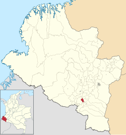
Location of the municipality and town of Gualmatán in the Nariño Department of Colombia.
 Colombia
Gualmatán (full name, San Francisco del Líbano de Gualmatán), is a town and municipality in the Nariño Department, Colombia.
Climate
Gualmatán has a comfortable subtropical highland climate (Köppen Cfb) with moderate rainfall year-round.
| Climate data for Gualmatán | |||||||||||||
|---|---|---|---|---|---|---|---|---|---|---|---|---|---|
| Month | Jan | Feb | Mar | Apr | May | Jun | Jul | Aug | Sep | Oct | Nov | Dec | Year |
| Mean daily maximum °C (°F) | 16.7 (62.1) | 16.6 (61.9) | 16.7 (62.1) | 16.9 (62.4) | 16.8 (62.2) | 16.0 (60.8) | 15.5 (59.9) | 15.9 (60.6) | 16.5 (61.7) | 17.1 (62.8) | 17.0 (62.6) | 16.8 (62.2) | 16.5 (61.8) |
| Daily mean °C (°F) | 11.8 (53.2) | 11.8 (53.2) | 12.0 (53.6) | 12.2 (54.0) | 12.0 (53.6) | 11.4 (52.5) | 10.8 (51.4) | 10.9 (51.6) | 11.3 (52.3) | 12.0 (53.6) | 12.0 (53.6) | 12.1 (53.8) | 11.7 (53.0) |
| Mean daily minimum °C (°F) | 6.9 (44.4) | 7.1 (44.8) | 7.3 (45.1) | 7.5 (45.5) | 7.3 (45.1) | 6.8 (44.2) | 6.2 (43.2) | 6.1 (43.0) | 6.2 (43.2) | 6.9 (44.4) | 7.0 (44.6) | 7.4 (45.3) | 6.9 (44.4) |
| Average rainfall mm (inches) | 63.0 (2.48) | 78.3 (3.08) | 104.2 (4.10) | 99.9 (3.93) | 93.8 (3.69) | 56.9 (2.24) | 48.0 (1.89) | 39.3 (1.55) | 61.6 (2.43) | 94.5 (3.72) | 97.2 (3.83) | 86.2 (3.39) | 922.9 (36.33) |
| Average rainy days | 12 | 13 | 15 | 15 | 17 | 14 | 14 | 14 | 12 | 15 | 16 | 15 | 172 |
| Source 1: Instituto de Hidrología, Meteorología y Estudios Ambientales[1] | |||||||||||||
| Source 2: [2] | |||||||||||||
References
- v
- t
- e
Municipalities in the Nariño Department
- Albán
- Aldana
- Ancuya
- Arboleda
- Barbacoas
- Belén
- Buesaco
- Chachagüí
- Colón (Génova)
- Consaca
- Contadero
- Córdoba
- Cuaspud
- Cumbal
- Cumbitara
- El Charco
- El Peñol
- El Rosario
- El Tablón
- El Tambo
- Francisco Pizarro
- Funes
- Guachucal
- Guaitarilla
- Gualmatán
- Iles
- Imués
- Ipiales
- La Cruz
- La Florida
- La Llanada
- La Tola
- La Unión
- Leiva
- Linares
- Los Andes
- Magüí Payán
- Mallama
- Mosquera
- Nariño
- Olaya Herrera
- Ospina
- Pasto
- Policarpa
- Potosí
- Providencia
- Puerres
- Pupiales
- Ricaurte
- Roberto Payán
- Samaniego
- San Bernardo
- Sandona
- San Lorenzo
- San Pablo
- San Pedro de Cartago
- Santa Barbara
- Santacruz
- Sapuyes
- Taminango
- Tangua
- Tumaco
- Tuquerres
- Yacuanquer

0°55′09″N 77°33′58″W / 0.919167°N 77.5661°W / 0.919167; -77.5661
 | This Department of Nariño location article is a stub. You can help Wikipedia by expanding it. |
- v
- t
- e


