Hamboki
Village in Punjab, Pakistan
Hamboki ہمبوکی | |
|---|---|
Village | |
| 32°08′26″N 73°54′10″E / 32.140656°N 73.902732°E / 32.140656; 73.902732 | |
| Country | Pakistan |
| Province | Punjab |
| Population (2020) | |
| • Total | 4,000 |
| Time zone | UTC+5 (PST) |
Hamboki is a large village, in Tehsil Nowshera Virkan, Punjab, Pakistan. It is situated 33 km west from Gujranwala.
Geography
Village is located in the west of district Gujranwala, on Nokhar to Alipur road. It is direct connect to nearly town Qila Didar Singh. Its coordinates are 31.6896° N, 75.2377°E.[1]
- East : Philloki, Nurpur
- West : Badoki Saikhwan,[2][circular reference] Udhowali
- South : Nokhar
- North: Bakhshish Pura
History
In 18th century, village was a part of late destroyed city Maka. Now Maka is also a small village, Makewali and Hamboki is a separated village having much population. Peoples are confused by the origin of name Hamboki.
There are some buildings having origin from British Rule.[3]
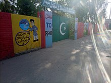
Education
The education system of Village is good but literacy rate is very low. There are many Public and Private institutes in village.[4] The literacy rate is about 59%.
Schools
- Govt. Elementary School, Hamboki
- Govt. Primary School Hamboki.
- Alfatah Academy
- Rahman Public School
- Subhan Ideal School System
Facilities
The village streets are paved. Gas and electricity are available. There is no Rural Health Centre in the village altougth there are some private clinics. There are two fuel stations in the village.
Economy
GDP per capita is 20000 PKR. Agriculture is one of main occupation of villagers.
Nearby villages
- Udhowali
- Badoki Saikhwan
- Nokhar
- Philloki


