Ji-Paraná River
River in Brazil
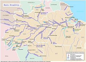

Location of the mouth of the Ji-Paraná River in the Amazonas watershed
• location
• coordinates
• elevation
The Ji-Paraná River (Machado River), sometimes spelled Jiparaná, is a river in Rondônia state in western Brazil. It is a tributary of the Madeira River in the Amazon Basin. For much of its length it runs roughly parallel with the northeastern state border of Rondônia. The city of Ji-Paraná is divided by the river.
Part of the river's basin is covered by the 221,218 hectares (546,640 acres) Jacundá National Forest, a sustainable use conservation unit.[3] Part of the basin is in the 346,861 hectares (857,110 acres) Jaru Biological Reserve, a fully protected conservation unit created in 1984.[4] The river forms the southern boundary in Rondônia of the Campos Amazônicos National Park, a 961,318 hectares (2,375,470 acres) protected area created in 2006 that holds an unusual enclave of cerrado vegetation in the Amazon rainforest.[5]
See also
References
- Brazilian Ministry of Transport
- ^ Ziesler, R.; Ardizzone, G.D. (1979). "Amazon River System". The Inland waters of Latin America. Food and Agriculture Organization of the United Nations. ISBN 92-5-000780-9. Archived from the original on 21 October 2013.
- ^ a b c d Prof. Carlos, Vieira da Silva; Prof. Carlos Eduardo, Norelli Tucci; Prof. José, Almir Cirilo; Prof. Luciene, Pimentel da Silva; Prof. Otto, Corrêa Roturno Filho; Prof. Benoit, Le Guennec (2006). "SIMULAÇÃO HIDROLÓGICA NA AMAZÔNIA: RIO MADEIRA".
- ^ Unidade de Conservação: Floresta Nacional de Jacundá (in Portuguese), MMA: Ministério do Meio Ambiente, retrieved 2016-05-16
- ^ Unidade de Conservação: Reserva Biológica do Jaru (in Portuguese), MMA: Ministério do Meio Ambiente, retrieved 2016-04-27
- ^ Parna Campos Amazônicos Mapa Interativo (in Portuguese), Chico Mendes Institute for Biodiversity Conservation, archived from the original on 2016-08-17, retrieved 2016-06-03
- v
- t
- e


