Juniper, Georgia
Unincorporated community in Georgia, United States
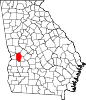
32°31′53″N 84°36′16″W / 32.53139°N 84.60444°W / 32.53139; -84.60444Juniper /ˈdʒʌnɪpər/ juu-nih-pər is an unincorporated community in Marion County, Georgia, United States. It lies along State Route 355 on the Talbot County line, to the north of the city of Buena Vista, the county seat of Marion County.[1] Its elevation is 413 feet (126 m).[2] It is part of the Columbus, Georgia Metropolitan Area.
The community takes its name from nearby Juniper Creek.[3]
References
- ^ Rand McNally. The Road Atlas '05. Skokie: Rand McNally, 2005, p. 28.
- ^ U.S. Geological Survey Geographic Names Information System: Juniper, Georgia, Geographic Names Information System, 1979-09-25. Accessed 2007-12-26.
- ^ Krakow, Kenneth K. (1975). Georgia Place-Names: Their History and Origins (PDF). Macon, GA: Winship Press. p. 123. ISBN 0-915430-00-2.
- v
- t
- e
Municipalities and communities of Marion County, Georgia, United States
County seat: Buena Vista
unincorporated
communities
- Church Hill
- Juniper
- Georgia portal
- United States portal
| ||
|---|---|---|
| Central cities/largest cities |  Columbus, Georgia Metropolitan Statistical Area Auburn, Alabama Metropolitan Statistical Area Tuskegee, Alabama Micropolitan Statistical Area (defunct) | |
| Cities in Georgia | ||
| Cities in Alabama | ||
| Counties in Georgia | ||
| Counties in Alabama | ||
 | This Marion County, Georgia state location article is a stub. You can help Wikipedia by expanding it. |
- v
- t
- e


