Miranda, Cauca
Colombian municipality and town in Cauca Department

Flag

Seal
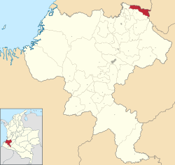
Location of the municipality and town of Miranda, Cauca in the Cauca Department of Colombia.
(2020 est.[1])
Miranda is a town and municipality in the Cauca Department, Colombia.
History
It was on May 7, 1899, when Don Julio Fernández Medina founded the city, since then the community mixed among Afro-Descendant, Indigenous people, Mulattoes and from different regions have built one of the most prosperous towns in the department. Today Miranda has strengths in the agroindustrial field, and growth in the tourism sector, because the natural wealth framed in its rivers, makes natural spas suitable for national and foreign tourists. Precisely in this year – towards the month of October – the War of the Thousand Days broke out, that lived in the Municipality of Miranda, it was known with the name of Revolution of the Manigua, according to narration of the caloteño historian Mariano Sendoya.[2]
Climate
| Climate data for Miranda, elevation 1,128 m (3,701 ft), (1981–2010) | |||||||||||||
|---|---|---|---|---|---|---|---|---|---|---|---|---|---|
| Month | Jan | Feb | Mar | Apr | May | Jun | Jul | Aug | Sep | Oct | Nov | Dec | Year |
| Mean daily maximum °C (°F) | 29.3 (84.7) | 29.5 (85.1) | 29.5 (85.1) | 29.1 (84.4) | 28.6 (83.5) | 29.0 (84.2) | 29.4 (84.9) | 29.7 (85.5) | 29.4 (84.9) | 28.5 (83.3) | 28.3 (82.9) | 28.7 (83.7) | 29.2 (84.6) |
| Daily mean °C (°F) | 23.5 (74.3) | 23.6 (74.5) | 23.6 (74.5) | 23.5 (74.3) | 23.4 (74.1) | 23.5 (74.3) | 23.6 (74.5) | 23.9 (75.0) | 23.6 (74.5) | 23.2 (73.8) | 23.1 (73.6) | 23.3 (73.9) | 23.5 (74.3) |
| Mean daily minimum °C (°F) | 18.1 (64.6) | 18.2 (64.8) | 18.3 (64.9) | 18.3 (64.9) | 18.4 (65.1) | 18.2 (64.8) | 17.9 (64.2) | 18.1 (64.6) | 18.1 (64.6) | 18.0 (64.4) | 18.0 (64.4) | 18.1 (64.6) | 18.1 (64.6) |
| Average precipitation mm (inches) | 118.8 (4.68) | 118.0 (4.65) | 155.5 (6.12) | 203.0 (7.99) | 120.4 (4.74) | 73.6 (2.90) | 55.6 (2.19) | 45.1 (1.78) | 117.6 (4.63) | 221.9 (8.74) | 213.8 (8.42) | 123.1 (4.85) | 1,554.3 (61.19) |
| Average precipitation days | 12 | 11 | 15 | 17 | 17 | 13 | 11 | 9 | 13 | 19 | 17 | 14 | 164 |
| Average relative humidity (%) | 84 | 83 | 83 | 84 | 84 | 83 | 81 | 80 | 82 | 83 | 83 | 83 | 83 |
| Mean monthly sunshine hours | 148.8 | 127.0 | 124.0 | 105.0 | 105.4 | 114.0 | 139.5 | 139.5 | 114.0 | 114.7 | 117.0 | 127.1 | 1,476 |
| Mean daily sunshine hours | 4.8 | 4.5 | 4.0 | 3.5 | 3.4 | 3.8 | 4.5 | 4.5 | 3.8 | 3.7 | 3.9 | 4.1 | 4.0 |
| Source: Instituto de Hidrologia Meteorologia y Estudios Ambientales[3] | |||||||||||||
| Climate data for Miranda (Ing Cauca), elevation 1,000 m (3,300 ft), (1981–2010) | |||||||||||||
|---|---|---|---|---|---|---|---|---|---|---|---|---|---|
| Month | Jan | Feb | Mar | Apr | May | Jun | Jul | Aug | Sep | Oct | Nov | Dec | Year |
| Mean daily maximum °C (°F) | 30.0 (86.0) | 30.3 (86.5) | 30.3 (86.5) | 29.6 (85.3) | 29.4 (84.9) | 29.6 (85.3) | 29.9 (85.8) | 30.3 (86.5) | 30.1 (86.2) | 29.4 (84.9) | 29.0 (84.2) | 29.4 (84.9) | 29.8 (85.6) |
| Daily mean °C (°F) | 23.6 (74.5) | 23.7 (74.7) | 23.6 (74.5) | 23.4 (74.1) | 23.4 (74.1) | 23.5 (74.3) | 23.6 (74.5) | 23.8 (74.8) | 23.5 (74.3) | 23.2 (73.8) | 22.9 (73.2) | 23.3 (73.9) | 23.5 (74.3) |
| Mean daily minimum °C (°F) | 18.6 (65.5) | 18.8 (65.8) | 18.7 (65.7) | 19.1 (66.4) | 19.1 (66.4) | 18.8 (65.8) | 18.2 (64.8) | 18.0 (64.4) | 18.2 (64.8) | 18.5 (65.3) | 18.8 (65.8) | 18.7 (65.7) | 18.6 (65.5) |
| Average precipitation mm (inches) | 98.2 (3.87) | 102.6 (4.04) | 143.6 (5.65) | 206.6 (8.13) | 158.1 (6.22) | 101.3 (3.99) | 71.6 (2.82) | 67.3 (2.65) | 123.7 (4.87) | 182.1 (7.17) | 182.6 (7.19) | 113.3 (4.46) | 1,518 (59.8) |
| Average precipitation days | 10 | 11 | 14 | 17 | 16 | 12 | 9 | 9 | 12 | 17 | 16 | 13 | 150 |
| Average relative humidity (%) | 79 | 79 | 79 | 81 | 81 | 80 | 77 | 77 | 78 | 80 | 82 | 81 | 79 |
| Mean monthly sunshine hours | 167.4 | 149.6 | 145.7 | 132.0 | 136.4 | 138.0 | 161.2 | 164.3 | 138.0 | 145.7 | 144.0 | 151.9 | 1,774.2 |
| Mean daily sunshine hours | 5.4 | 5.3 | 4.7 | 4.4 | 4.4 | 4.6 | 5.2 | 5.3 | 4.6 | 4.7 | 4.8 | 4.9 | 4.9 |
| Source: Instituto de Hidrologia Meteorologia y Estudios Ambientales[3] | |||||||||||||
References
- ^ "Resultados y proyecciones (2005-2020) del censo 2005". Retrieved April 12, 2020.
- ^ "Miranda, Cauca, celebra sus 113 años de fundación". Proclama del Cauca (In Spanish). Retrieved January 10, 2018.
- ^ a b "Promedios Climatológicos 1981–2010" (in Spanish). Instituto de Hidrologia Meteorologia y Estudios Ambientales. Archived from the original on August 15, 2016. Retrieved June 17, 2024.
- v
- t
- e
Municipalities in the Cauca Department
- Almaguer
- Argelia
- Balboa
- Bolívar
- Buenos Aires
- Cajibio
- Caldono
- Caloto
- Corinto
- El Tambo
- Florencia
- Guachené
- Guapi
- Inzá
- Jambaló
- La Sierra
- La Vega
- López de Micay
- Mercaderes
- Miranda
- Morales
- Padilla
- Páez
- Patía
- Piamonte
- Piendamó
- Popayán
- Puerto Tejada
- Puracé
- Rosas
- San Sebastián
- Santander de Quilichao
- Santa Rosa
- Silvia
- Sotara
- Suárez
- Sucre
- Timbío
- Timbiquí
- Toribío
- Totoró
- Villa Rica

Authority control databases | |
|---|---|
| International |
|
| National |
|
3°15′N 76°15′W / 3.250°N 76.250°W / 3.250; -76.250
 | This Department of Cauca location article is a stub. You can help Wikipedia by expanding it. |
- v
- t
- e


