Mont-Cauvaire
Commune in Normandy, France

Coat of arms
Location of Mont-Cauvaire

(2020–2026) Stéphanie Lambard[1]
1
(2021)[2]
76443 /76690
(avg. 175 m or 574 ft)
Mont-Cauvaire (French pronunciation: [mɔ̃ kovɛʁ]) is a commune in the Seine-Maritime department in the Normandy region in northern France.
Geography
A farming village, situated along the banks of the river Cailly in the Pays de Caux, some 10 miles (16 km) north of Rouen on the D3 road.
Heraldry
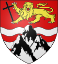 | The arms of Mont-Cauvaire are blazoned : Gules, 2 fesses wavy abased, with a triple-peaked mount argent over them, in chief a leopard Or armed sable, langued gules, holding a latin cross bendwise sable.
|
Population
| Year | Pop. | ±% p.a. |
|---|---|---|
| 1968 | 451 | — |
| 1975 | 471 | +0.62% |
| 1982 | 557 | +2.42% |
| 1990 | 603 | +1.00% |
| 1999 | 566 | −0.70% |
| 2007 | 611 | +0.96% |
| 2012 | 627 | +0.52% |
| 2017 | 741 | +3.40% |
| Source: INSEE[3] | ||
Places of interest
- The church of St.Martin, dating from the nineteenth century.
- A sixteenth century sandstone cross.
- The seventeenth century Château du Rombosc, with its chapel, and parkland.
- The Château du Fossé, dating from the seventeenth century.
- The eighteenth century Pavillon de La Tourelle and its parkland.
- Two dovecotes and a communal oven.
See also
References
- ^ Liste des maires du département de la Seine-Maritime, 10 August 2020
- ^ "Populations légales 2021". The National Institute of Statistics and Economic Studies. 28 December 2023.
- ^ Population en historique depuis 1968, INSEE
Wikimedia Commons has media related to Mont-Cauvaire.
- v
- t
- e
Communes of the Seine-Maritime department 

- Allouville-Bellefosse
- Alvimare
- Ambrumesnil
- Amfreville-la-Mi-Voie
- Amfreville-les-Champs
- Anceaumeville
- Ancourt
- Ancourteville-sur-Héricourt
- Ancretiéville-Saint-Victor
- Ancretteville-sur-Mer
- Angerville-Bailleul
- Angerville-la-Martel
- Angerville-l'Orcher
- Angiens
- Anglesqueville-l'Esneval
- Anglesqueville-la-Bras-Long
- Anneville-Ambourville
- Anneville-sur-Scie
- Annouville-Vilmesnil
- Anquetierville
- Anvéville
- Ardouval
- Arelaune-en-Seine
- Argueil
- Arques-la-Bataille
- Aubéguimont
- Aubermesnil-aux-Érables
- Aubermesnil-Beaumais
- Auberville-la-Manuel
- Auberville-la-Renault
- Aumale
- Auppegard
- Authieux-Ratiéville
- Les Authieux-sur-le-Port-Saint-Ouen
- Autigny
- Auvilliers
- Auzebosc
- Auzouville-l'Esneval
- Auzouville-sur-Ry
- Auzouville-sur-Saâne
- Avesnes-en-Bray
- Avesnes-en-Val
- Avremesnil
- Bacqueville-en-Caux
- Bailleul-Neuville
- Baillolet
- Bailly-en-Rivière
- Baons-le-Comte
- Bardouville
- Barentin
- Baromesnil
- Bazinval
- Beaubec-la-Rosière
- Beaumont-le-Hareng
- Beaurepaire
- Beaussault
- Beautot
- Beauval-en-Caux
- Beauvoir-en-Lyons
- Bec-de-Mortagne
- Belbeuf
- Bellencombre
- Bellengreville
- Belleville-en-Caux
- La Bellière
- Belmesnil
- Bénarville
- Bénesville
- Bénouville
- Bernières
- Bertheauville
- Bertreville
- Bertreville-Saint-Ouen
- Bertrimont
- Berville-en-Caux
- Berville-sur-Seine
- Beuzeville-la-Grenier
- Beuzeville-la-Guérard
- Beuzevillette
- Bézancourt
- Bierville
- Bihorel
- Biville-la-Baignarde
- Biville-la-Rivière
- Blacqueville
- Blainville-Crevon
- Blangy-sur-Bresle
- Blosseville
- Le Bocasse
- Bois-d'Ennebourg
- Bois-Guilbert
- Bois-Guillaume
- Bois-Héroult
- Bois-Himont
- Bois-l'Évêque
- Le Bois-Robert
- Boissay
- Bolbec
- Bolleville
- Bonsecours
- Boos
- Bordeaux-Saint-Clair
- Bornambusc
- Bosc-Bérenger
- Bosc-Bordel
- Bosc-Édeline
- Bosc-Guérard-Saint-Adrien
- Bosc-Hyons
- Bosc-le-Hard
- Bosc-Mesnil
- Bosville
- Boudeville
- Bouelles
- La Bouille
- Bourdainville
- Le Bourg-Dun
- Bourville
- Bouville
- Brachy
- Bracquetuit
- Bradiancourt
- Brametot
- Bréauté
- Brémontier-Merval
- Bretteville-du-Grand-Caux
- Bretteville-Saint-Laurent
- Buchy
- Bully
- Bures-en-Bray
- Butot
- Butot-Vénesville
- Cailleville
- Cailly
- Callengeville
- Calleville-les-Deux-Églises
- Campneuseville
- Canehan
- Canouville
- Canteleu
- Canville-les-Deux-Églises
- Cany-Barville
- Carville-la-Folletière
- Carville-Pot-de-Fer
- Le Catelier
- Catenay
- Caudebec-lès-Elbeuf
- Le Caule-Sainte-Beuve
- Cauville-sur-Mer
- Les Cent-Acres
- La Cerlangue
- La Chapelle-du-Bourgay
- La Chapelle-Saint-Ouen
- La Chapelle-sur-Dun
- La Chaussée
- Cideville
- Clais
- Clasville
- Claville-Motteville
- Cléon
- Clères
- Cleuville
- Cléville
- Cliponville
- Colleville
- Colmesnil-Manneville
- Compainville
- Conteville
- Contremoulins
- Cottévrard
- Crasville-la-Mallet
- Crasville-la-Rocquefort
- Criel-sur-Mer
- La Crique
- Criquebeuf-en-Caux
- Criquetot-l'Esneval
- Criquetot-le-Mauconduit
- Criquetot-sur-Longueville
- Criquetot-sur-Ouville
- Criquiers
- Critot
- Croisy-sur-Andelle
- Croixdalle
- Croix-Mare
- Cropus
- Crosville-sur-Scie
- Cuverville
- Cuverville-sur-Yères
- Cuy-Saint-Fiacre
- Dampierre-en-Bray
- Dampierre-Saint-Nicolas
- Dancourt
- Darnétal
- Daubeuf-Serville
- Dénestanville
- Déville-lès-Rouen
- Dieppesubpr
- Doudeauville
- Doudeville
- Douvrend
- Drosay
- Duclair
- Écalles-Alix
- Écrainville
- Écretteville-lès-Baons
- Écretteville-sur-Mer
- Ectot-l'Auber
- Ectot-lès-Baons
- Elbeuf
- Elbeuf-en-Bray
- Elbeuf-sur-Andelle
- Életot
- Ellecourt
- Émanville
- Envermeu
- Envronville
- Épinay-sur-Duclair
- Épouville
- Épretot
- Épreville
- Ermenouville
- Ernemont-la-Villette
- Ernemont-sur-Buchy
- Esclavelles
- Eslettes
- Esteville
- Étaimpuis
- Étainhus
- Étalleville
- Étalondes
- Étoutteville
- Étretat
- Eu
- Fallencourt
- Fécamp
- Ferrières-en-Bray
- La Ferté-Saint-Samson
- Fesques
- La Feuillie
- Flamanville
- Flamets-Frétils
- Flocques
- Fongueusemare
- Fontaine-en-Bray
- Fontaine-la-Mallet
- Fontaine-le-Bourg
- Fontaine-le-Dun
- Fontaine-sous-Préaux
- La Fontelaye
- Fontenay
- Forges-les-Eaux
- Foucarmont
- Foucart
- Franqueville-Saint-Pierre
- Fréauville
- La Frénaye
- Freneuse
- Fresles
- Fresnay-le-Long
- Fresne-le-Plan
- Fresnoy-Folny
- Fresquiennes
- Freulleville
- Frichemesnil
- Froberville
- Fry
- Fultot
- La Gaillarde
- Gaillefontaine
- Gainneville
- Gancourt-Saint-Étienne
- Ganzeville
- Gerponville
- Gerville
- Goderville
- Gommerville
- Gonfreville-Caillot
- Gonfreville-l'Orcher
- Gonnetot
- Gonneville-la-Mallet
- Gonneville-sur-Scie
- Gonzeville
- Goupillières
- Gournay-en-Bray
- Gouy
- Graimbouville
- Grainville-la-Teinturière
- Grainville-sur-Ry
- Grainville-Ymauville
- Grand-Camp
- Grand-Couronne
- Grandcourt
- Les Grandes-Ventes
- Le Grand-Quevilly
- Graval
- Grèges
- Grémonville
- Greuville
- Grigneuseville
- Gruchet-le-Valasse
- Gruchet-Saint-Siméon
- Grugny
- Grumesnil
- Guerville
- Gueures
- Gueutteville
- Gueutteville-les-Grès
- La Hallotière
- Le Hanouard
- Harcanville
- Harfleur
- Hattenville
- Haucourt
- Haudricourt
- Haussez
- Hautot-l'Auvray
- Hautot-le-Vatois
- Hautot-Saint-Sulpice
- Hautot-sur-Mer
- Hautot-sur-Seine
- Les Hauts-de-Caux
- Le Havresubpr
- La Haye
- Héberville
- Hénouville
- Héricourt-en-Caux
- Hermanville
- Hermeville
- Le Héron
- Héronchelles
- Heugleville-sur-Scie
- Heuqueville
- Heurteauville
- Hodeng-au-Bosc
- Hodeng-Hodenger
- Houdetot
- Le Houlme
- Houppeville
- Houquetot
- La Houssaye-Béranger
- Hugleville-en-Caux
- Les Ifs
- Illois
- Imbleville
- Incheville
- Ingouville
- Isneauville
- Jumièges
- Lamberville
- Lammerville
- Landes-Vieilles-et-Neuves
- Lanquetot
- Lestanville
- Lillebonne
- Limésy
- Limpiville
- Lindebeuf
- Lintot
- Lintot-les-Bois
- Les Loges
- La Londe
- Londinières
- Longmesnil
- Longroy
- Longueil
- Longuerue
- Longueville-sur-Scie
- Louvetot
- Lucy
- Luneray
- Malaunay
- Malleville-les-Grès
- Manéglise
- Manéhouville
- Maniquerville
- Manneville-ès-Plains
- Manneville-la-Goupil
- Mannevillette
- Maromme
- Marques
- Martainville-Épreville
- Martigny
- Martin-Église
- Massy
- Mathonville
- Maucomble
- Maulévrier-Sainte-Gertrude
- Mauny
- Mauquenchy
- Mélamare
- Melleville
- Ménerval
- Ménonval
- Mentheville
- Mésangueville
- Mesnières-en-Bray
- Le Mesnil-Durdent
- Le Mesnil-Esnard
- Mesnil-Follemprise
- Le Mesnil-Lieubray
- Mesnil-Mauger
- Mesnil-Panneville
- Mesnil-Raoul
- Le Mesnil-Réaume
- Le Mesnil-sous-Jumièges
- Meulers
- Millebosc
- Mirville
- Molagnies
- Monchaux-Soreng
- Monchy-sur-Eu
- Mont-Cauvaire
- Mont-Saint-Aignan
- Montérolier
- Montigny
- Montivilliers
- Montmain
- Montreuil-en-Caux
- Montroty
- Montville
- Morgny-la-Pommeraye
- Morienne
- Mortemer
- Morville-sur-Andelle
- Motteville
- Moulineaux
- Muchedent
- Nesle-Hodeng
- Nesle-Normandeuse
- Neufbosc
- Neufchâtel-en-Bray
- Neuf-Marché
- La Neuville-Chant-d'Oisel
- Neuville-Ferrières
- Néville
- Nointot
- Nolléval
- Normanville
- Norville
- Notre-Dame-d'Aliermont
- Notre-Dame-de-Bliquetuit
- Notre-Dame-de-Bondeville
- Notre-Dame-du-Bec
- Notre-Dame-du-Parc
- Nullemont
- Ocqueville
- Octeville-sur-Mer
- Offranville
- Oherville
- Oissel
- Omonville
- Orival
- Osmoy-Saint-Valery
- Ouainville
- Oudalle
- Ourville-en-Caux
- Ouville-l'Abbaye
- Ouville-la-Rivière
- Paluel
- Parc-d'Anxtot
- Pavilly
- Petit-Caux
- Petit-Couronne
- Le Petit-Quevilly
- Petiville
- Pierrecourt
- Pierrefiques
- Pierreval
- Pissy-Pôville
- Pleine-Sève
- Pommereux
- Pommeréval
- Ponts-et-Marais
- Port-Jérôme-sur-Seine
- La Poterie-Cap-d'Antifer
- Préaux
- Prétot-Vicquemare
- Preuseville
- Puisenval
- Quevillon
- Quévreville-la-Poterie
- Quiberville
- Quièvrecourt
- Quincampoix
- Raffetot
- Rainfreville
- Réalcamp
- Rebets
- La Remuée
- Rétonval
- Reuville
- Ricarville-du-Val
- Richemont
- Rieux
- Rives-en-Seine
- Riville
- Robertot
- Rocquefort
- Rocquemont
- Rogerville
- Rolleville
- Roncherolles-en-Bray
- Roncherolles-sur-le-Vivier
- Ronchois
- Rosay
- Rouenpref
- Roumare
- Routes
- Rouville
- Rouvray-Catillon
- Rouxmesnil-Bouteilles
- Royville
- La Rue-Saint-Pierre
- Ry
- Saâne-Saint-Just
- Sahurs
- Sainneville
- Saint-Aignan-sur-Ry
- Saint-André-sur-Cailly
- Saint-Antoine-la-Forêt
- Saint-Arnoult
- Saint-Aubin-Celloville
- Saint-Aubin-de-Crétot
- Saint-Aubin-Épinay
- Saint-Aubin-le-Cauf
- Saint-Aubin-lès-Elbeuf
- Saint-Aubin-Routot
- Saint-Aubin-sur-Mer
- Saint-Aubin-sur-Scie
- Saint-Clair-sur-les-Monts
- Saint-Crespin
- Saint-Denis-d'Aclon
- Saint-Denis-le-Thiboult
- Saint-Denis-sur-Scie
- Sainte-Adresse
- Sainte-Agathe-d'Aliermont
- Sainte-Austreberthe
- Sainte-Beuve-en-Rivière
- Sainte-Colombe
- Sainte-Croix-sur-Buchy
- Sainte-Foy
- Sainte-Geneviève
- Sainte-Hélène-Bondeville
- Sainte-Marguerite-sur-Duclair
- Sainte-Marguerite-sur-Mer
- Sainte-Marie-au-Bosc
- Sainte-Marie-des-Champs
- Saint-Étienne-du-Rouvray
- Saint-Eustache-la-Forêt
- Saint-Georges-sur-Fontaine
- Saint-Germain-des-Essourts
- Saint-Germain-d'Étables
- Saint-Germain-sous-Cailly
- Saint-Germain-sur-Eaulne
- Saint-Gilles-de-Crétot
- Saint-Gilles-de-la-Neuville
- Saint-Hellier
- Saint-Honoré
- Saint-Jacques-d'Aliermont
- Saint-Jacques-sur-Darnétal
- Saint-Jean-de-Folleville
- Saint-Jean-de-la-Neuville
- Saint-Jean-du-Cardonnay
- Saint-Jouin-Bruneval
- Saint-Laurent-de-Brèvedent
- Saint-Laurent-en-Caux
- Saint-Léger-aux-Bois
- Saint-Léger-du-Bourg-Denis
- Saint-Léonard
- Saint-Lucien
- Saint-Maclou-de-Folleville
- Saint-Maclou-la-Brière
- Saint-Mards
- Saint-Martin-au-Bosc
- Saint-Martin-aux-Arbres
- Saint-Martin-aux-Buneaux
- Saint-Martin-de-Boscherville
- Saint-Martin-de-l'If
- Saint-Martin-du-Bec
- Saint-Martin-du-Manoir
- Saint-Martin-du-Vivier
- Saint-Martin-le-Gaillard
- Saint-Martin-l'Hortier
- Saint-Martin-Osmonville
- Saint-Maurice-d'Ételan
- Saint-Michel-d'Halescourt
- Saint-Nicolas-d'Aliermont
- Saint-Nicolas-de-la-Haie
- Saint-Nicolas-de-la-Taille
- Saint-Ouen-du-Breuil
- Saint-Ouen-le-Mauger
- Saint-Ouen-sous-Bailly
- Saint-Paër
- Saint-Pierre-Bénouville
- Saint-Pierre-de-Manneville
- Saint-Pierre-des-Jonquières
- Saint-Pierre-de-Varengeville
- Saint-Pierre-en-Port
- Saint-Pierre-en-Val
- Saint-Pierre-lès-Elbeuf
- Saint-Pierre-le-Vieux
- Saint-Pierre-le-Viger
- Saint-Rémy-Boscrocourt
- Saint-Riquier-en-Rivière
- Saint-Riquier-ès-Plains
- Saint-Romain-de-Colbosc
- Saint-Saëns
- Saint-Saire
- Saint-Sauveur-d'Émalleville
- Saint-Sylvain
- Saint-Vaast-d'Équiqueville
- Saint-Vaast-Dieppedalle
- Saint-Vaast-du-Val
- Saint-Valery-en-Caux
- Saint-Victor-l'Abbaye
- Saint-Vigor-d'Ymonville
- Saint-Vincent-Cramesnil
- Sandouville
- Sassetot-le-Malgardé
- Sassetot-le-Mauconduit
- Sasseville
- Sauchay
- Saumont-la-Poterie
- Sauqueville
- Saussay
- Sausseuzemare-en-Caux
- Senneville-sur-Fécamp
- Sept-Meules
- Serqueux
- Servaville-Salmonville
- Sierville
- Sigy-en-Bray
- Smermesnil
- Sommery
- Sommesnil
- Sorquainville
- Sotteville-lès-Rouen
- Sotteville-sous-le-Val
- Sotteville-sur-Mer
- Tancarville
- Terres-de-Caux
- Thérouldeville
- Theuville-aux-Maillots
- Thiergeville
- Thiétreville
- Thil-Manneville
- Le Thil-Riberpré
- Thiouville
- Le Tilleul
- Tocqueville-en-Caux
- Tocqueville-les-Murs
- Torcy-le-Grand
- Torcy-le-Petit
- Le Torp-Mesnil
- Tôtes
- Touffreville-la-Corbeline
- Touffreville-sur-Eu
- Tourville-la-Rivière
- Tourville-les-Ifs
- Tourville-sur-Arques
- Toussaint
- Le Trait
- Trémauville
- Le Tréport
- La Trinité-du-Mont
- Les Trois-Pierres
- Trouville
- Turretot
- Val-de-la-Haye
- Val-de-Saâne
- Val-de-Scie
- Valliquerville
- Valmont
- Varengeville-sur-Mer
- Varneville-Bretteville
- Vassonville
- Vatierville
- Vattetot-sous-Beaumont
- Vattetot-sur-Mer
- Vatteville-la-Rue
- La Vaupalière
- Veauville-lès-Quelles
- Vénestanville
- Ventes-Saint-Rémy
- Vergetot
- Veules-les-Roses
- Veulettes-sur-Mer
- Vibeuf
- Vieux-Manoir
- Vieux-Rouen-sur-Bresle
- La Vieux-Rue
- Villainville
- Villers-Écalles
- Villers-sous-Foucarmont
- Villy-sur-Yères
- Vinnemerville
- Virville
- Vittefleur
- Wanchy-Capval
- Yainville
- Yébleron
- Yerville
- Ymare
- Yport
- Ypreville-Biville
- Yquebeuf
- Yvecrique
- Yvetot
- Yville-sur-Seine
- pref: prefecture
- subpr: subprefecture
Authority control databases | |
|---|---|
| International |
|
| National |
|
This Rouen geographical article is a stub. You can help Wikipedia by expanding it. |
- v
- t
- e


