Mount Flume


Mount Flume
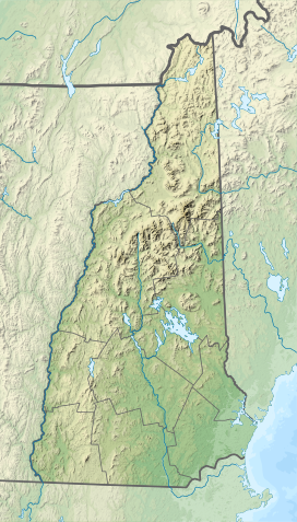
Mount Flume (the United States)
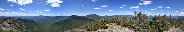
Show map of the United StatesMount Flume is a 4,328-foot (1,319 m)[1] mountain at the southern end of the Franconia Range in the White Mountains of New Hampshire, United States. Mount Flume is the lowest in elevation of the peaks in the Franconia Range that are accessible by official hiking trails.
The summit marks the western border of the Pemigewasset Wilderness within the White Mountain National Forest. From the summit, there are outstanding views of Franconia Notch and the Kinsman Range to the west and the Franconia Range to the north, with limited views of the Pemigewasset Wilderness and the Twin Range to the east.
Hiking
The peak can be reached from the southeast by starting on the Lincoln Woods Trail and turning onto the Osseo Trail, for a total of 5.6 miles (9.0 km) with a 3,150-foot (960 m) elevation gain. From the west the peak can be climbed via the Liberty Spring Trail, followed by the Flume Slide Trail, for a total of 4.1 miles (6.6 km) with a 2,950-foot (899 m) elevation gain. From the north the summit is reached by the Franconia Ridge Trail coming from the summit of Mount Liberty. The Flume Slide Trail is a notably steep and slippery climb, and its use is discouraged in wet weather or snow. It is not recommended as a descending trail.[3]
See also
 New Hampshire portal

- Four-thousand footers
- White Mountains Region
- List of mountains of New Hampshire
References
- ^ a b c "Mount Flume, New Hampshire". Peakbagger.com. Retrieved 2010-03-23.
- ^ "Mount Flume". Geographic Names Information System. United States Geological Survey, United States Department of the Interior. Retrieved 2010-03-23.
- ^ Smith, Steven D. (2017). White Mountain Guide: AMC's comprehensive guide to hiking trails in the White Mountain National Forest (30th ed.). Boston. pp. 160–161, 191–192. ISBN 978-1-934028-85-8.
{{cite book}}: CS1 maint: location missing publisher (link)
- v
- t
- e
- Bayle Mountain
- Larcom Mountain
- Mount Roberts
- Mount Shaw
- Mount Whittier
- Nickerson Mountain
- Turtleback Mountain
- Blue Job Mountain
- Crotched Mountain
- Gap Mountain
- Little Monadnock Mountain
- Lovewell Mountain
- Moose Mountain
- Mount Assurance
- Mount Cardigan
- Mount Kearsarge
- Mount Kelsey
- Mount Magalloway
- Mount Monadnock
- Mount Sunapee
- Pitcher Mountain
- Potanipo Hill
- Ragged Mountain
- Skatutakee Mountain
- Smarts Mountain
- Tenney Mountain
- Thumb Mountain
- Uncanoonuc Mountains


