Mount Issa
Mountain in Naâma, Algeria

Djebel Aïssa
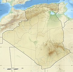
Algeria
Mount Issa or Djebel Aïssa (Arabic: جبل عيسى) is a 2,236 m high mountain in western Algeria, thus the 4th highest in Algeria. It is part of the Ksour Range of the Saharan Atlas, within the larger Atlas Mountain System.[1] Mount Issa is located in the Naâma Province and is one of the main summits of the mountains of the Saharan Atlas.
The Djebel Aissa National Park is a protected area within the area of the mountain since 2003.[2]
See also
- List of mountains in Algeria
- Saharan Atlas
References
External links
- Les montagnes d'atlas
- Persée - Notes de géographie physique algérienne
- v
- t
- e
 Mountains of Algeria
- Blidean Atlas
- Babor Mountains
- Beni-Chougrane
- Bibans
- Bouzegza Mount [ar]
- Constantine Mountains
- Chenoua Mount
- Dahra Range
- Djurdjura
- Edough
- Khachna
- Kroumirie
- Ouarsenis
- Medjerda Mountains
- Murdjajo
- Numidian Range
- Saïda Mountains
- Tlemcen Mountains
- Titteri
- Tessala Range
- Trara
- Yemma Gouraya
- Amour Range
- Aurès Mountains
- Belezma Range
- Hodna Mountains
- Ksour Range
- Ouled Naïl Range
- Nememcha Range
- Zab Mountains
- Achaoun
- Anneb
- Djebel Antar
- Djebel Azao
- Djebel Chélia
- Djebel Grouz
- Djebel Guetiane
- Djebel Tsili
- Koudiat Béni Arif
- Koudiat Sidi Abdelkader
- Lalla Khedidja
- Maouna
- Mount Babor
- Mount Bissa
- Mount Issa
- Mount Tahat
- Mount Tamgout
- Mount Zaccar
- Pic des Singes
- Taourirt Tan Afella
- Thaletat
 | This article about a location in Naama Province is a stub. You can help Wikipedia by expanding it. |
- v
- t
- e


