Natá District
District in Coclé, Panama
8°19′48″N 80°31′12″W / 8.33000°N 80.52000°W / 8.33000; -80.52000 Panama
 (2000)
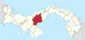
Natá is a district (distrito) of Coclé Province in Panama. The population according to the 2000 census was 17,811.[1] The district covers a total area of 608 km2. The capital lies at the city of Natá.[1]
Administrative divisions
Natá District is divided administratively into the following corregimientos:
- Natá de los Caballeros (capital)
- Capellanía
- El Caño
- Guzmán
- Las Huacas
- Toza
References
- ^ a b "Districts of Panama". Statoids. Retrieved April 10, 2009.
- v
- t
- e

Capital: Penonomé
- Penonomé
- Cañaveral
- Coclé
- Chiguirí Arriba
- El Coco
- Pajonal, Río Grande
- Río Indio
- Toabré
- Tulú
- El Valle de San Miguel
- Vista Hermosa
- Los Uveros
- El Silencio
| |
|---|---|
| Bocas del Toro Province | |
| Chiriquí Province | |
| Coclé Province | |
| Colón Province | |
| Darién Province | |
| Herrera Province | |
| Los Santos Province | |
| Panamá Province | |
| Veraguas Province | |
| West Panamá Province | |
8°19′48″N 80°31′12″W / 8.33000°N 80.52000°W / 8.33000; -80.52000
 | This article about the geography of Coclé Province is a stub. You can help Wikipedia by expanding it. |
- v
- t
- e


