New Mexico State Road 75
State highway in New Mexico, United States
Major junctions NM 68 West of Dixon 1 mile
 NM 580 in Dixon
 NM 73 in Peñasco
 NM 518 West of Sipapu Ski Area 4.8 miles
- New Mexico State Highway System
←  NM 74 NM 74 | →  NM 76 NM 76 |
New Mexico State Road 75 (NM 75) is a 20.6 mi (33.2 km) long state highway in Northern New Mexico, located in the Southwestern United States. NM 75 is located on the western slope of the Sangre de Cristo Mountains starting near the Rio Grande, passes through Pircuris Pueblo, and ends as a segment of the High Road to Taos near Peñasco.
Route description
NM 75 begins west near Dixon at its intersection with NM 68 . The road then runs east through the mountain villages of Rio Lucio, Peñasco, and Vadito, before reaching its eastern terminus at intersection of NM 518 4.8 miles west of Sipapu Ski Area. Starting at the intersection of NM 76, NM 75 is a segment of the High Road to Taos[2] for 7 miles until the intersection with NM 518.
NM 7 is a mountainous two-lane undivided highway with few passing lanes. It is relatively straight with few switchbacks. The road begins at 5,900-foot (1,800 m) elevation and climbs steadily to 7,500-foot (2,285 m). The speed limit is maximum 55-mile-per-hour (90 km/h), stretches of 50-mile-per-hour (80 km/h), and as low as 25-mile-per-hour (40 km/h) in the villages. NM 7 can be treacherous during winter conditions.
Major intersections
| County | Location | mi[3] | km | Destinations | Notes |
|---|---|---|---|---|---|
| Rio Arriba | Dixon | 0.000 | 0.000 | NM 68 | Western terminus |
| 3.301 | 5.312 |  NM 580 east – Cañoncito NM 580 east – Cañoncito | Western terminus of NM 580 | ||
| Taos | Picuris Pueblo | 13.662 | 21.987 |  NM 76 south – Truchas NM 76 south – Truchas | Northern terminus of NM 76, begin segment of the High Road to Taos |
| Peñasco | 15.180 | 24.430 | NM 73 east – Rodarte | Western terminus of NM 73 | |
| Vadito | 20.547 | 33.067 | NM 518 | Eastern terminus, end segment of the High Road to Taos | |
| 1.000 mi = 1.609 km; 1.000 km = 0.621 mi | |||||
Gallery
-
 Barrancos Blancos at the intersection of NM Route 68 and NM Route 75
 -
 Dixon, New Mexico. View looking west. Cerro Pedernal is the flat peak on the horizon left.
 -
 Carved tree trunk, Peñasco, New Mexico
 -
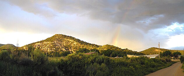 Rainbow over Vadito, New Mexico


See also
 U.S. Roads portal
References
- ^ "Posted Route–Legal Description" (PDF). New Mexico Department of Transportation. March 16, 2010. p. 19. Retrieved December 18, 2017.
- ^ "The High Road to Taos Scenic Byway". The High Road to Taos Scenic Byway. Retrieved 18 December 2017.
- ^ "TIMS Road Segments by Posted Route/Point with AADT Info; NM, NMX-Routes" (PDF). New Mexico Department of Transportation. June 8, 2016. p. 30. Retrieved December 12, 2017.
External links
KML file (edit • help)
Template:Attached KML/New Mexico State Road 75
KML is not from Wikidata
 Geographic data related to New Mexico State Road 75 at OpenStreetMap


