Ochoco West, Oregon
Census-designated place in Oregon, United States
44°24′11″N 120°55′15″W / 44.40306°N 120.92083°W / 44.40306; -120.92083 (2020)[2]
97754 (Prineville)
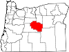
Ochoco West is a census-designated place (CDP) in Crook County, Oregon, United States. It was first listed as a CDP prior to the 2020 census.[3]
The CDP is in northwestern Crook County, 3 miles (5 km) northeast of U.S. Route 26, 10 miles (16 km) northwest of Prineville, the county seat, and 23 miles (37 km) southeast of Madras. The community is on the west side of the valley of Lytle Creek at the western foot of the Ochoco Mountains. Lytle Creek is a south-flowing tributary of the Crooked River and part of the Deschutes River watershed.
Demographics
| Census | Pop. | Note | %± |
|---|---|---|---|
| 2020 | 432 | — | |
| U.S. Decennial Census[4][2] | |||
References
- ^ "ArcGIS REST Services Directory". United States Census Bureau. Retrieved October 12, 2022.
- ^ a b "Census Population API". United States Census Bureau. Retrieved October 12, 2022.
- ^ a b "Ochoco West Census Designated Place". Geographic Names Information System. United States Geological Survey, United States Department of the Interior.
- ^ "Census of Population and Housing". Census.gov. Retrieved June 4, 2016.
- v
- t
- e
Municipalities and communities of Crook County, Oregon, United States
County seat: Prineville
- Juniper Canyon
- Ochoco West
- Prineville Lake Acres
communities
- Oregon portal
- United States portal
 | This Crook County, Oregon state location article is a stub. You can help Wikipedia by expanding it. |
- v
- t
- e


