Pienaarsrivier
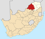
Place in Limpopo, South Africa
25°12′47″S 28°18′00″E / 25.213°S 28.300°E / -25.213; 28.300 (2011)[1]
0420
Pienaarsrivier is a town some 70 km (43 mi) due north of Pretoria, north of the Pienaars River. The river is named after Petrus Gerhardus Jacobus Pienaar, born 26 February 1819 in George, Cape Colony, who trekked to the then Transvaal in 1858. He became a local pioneer farmer, and reputedly shot an elephant whilst hunting in the area. The Setswana name of this river is Moretele, from which the Moreletaspruit derives its name. The town Pienaarsrivier was established in 1908. Pienaarsrivier is located within Bela Bela Local Municipality and serves as a Trans Provincial Region that connects Limpopo, Mpumalanga and Gauteng.[2]
References
- ^ a b c d "Main Place Pienaarsrivier". Census 2011.
- ^ Raper, Peter E. (1987). Dictionary of Southern African Place Names. Internet Archive. p. 366. Retrieved 28 August 2013.
- v
- t
- e
Municipalities and communities of Waterberg District Municipality, Limpopo
District seat: Nylstroom (Modimolle)
- Abbotspoort
- Ellisras (Lephalale)
- Onverwacht
- Villa Nora
- Alma
- Nylstroom (Modimolle)
- Naboomspruit (Mookgophong)
- Roedtan
- Vaalwater
- Warmbaths (Bela-Bela)
- Pienaarsrivier
- Eseldrift
- Lyden
- Ga-Tshipana
- Mahwelereng
- Wisconcin (Matsitsileng)
- Potgietersrus (Mokopane)
- Mosesetjane
- Sterkwater
- Tshamahansi
- Jakkalskuil
- Kabeane
- Bakenberg
 | This Limpopo location article is a stub. You can help Wikipedia by expanding it. |
- v
- t
- e


