Rio Verde de Mato Grosso
Municipality in Central-West, Brazil

Flag

Coat of arms

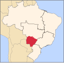
Location in Mato Grosso do Sul state
(2020 [1])
Rio Verde de Mato Grosso is a municipality located in the Brazilian state of Mato Grosso do Sul. Its population was 19,973 (2020) and its area is 8,152 km².
Rio Verde (which means "Green River" in English), how it's popularly called among the people from northern Mato Grosso do Sul, is a small town in the very edge of Serra da Alegria (which means "The Happiness Mountains"), close to the Pantanal of Nhecolândia (which means "The Blissful Burg"), one of the largest on earth. The following closest city is Coxim, an alternative center for backpackers and ecotourists from all over the world. Some of Rio Verde's great attractions are the Sete Quedas (Seven Falls), the Fazenda Igrejinha (Little Church Ranch) and the Jardim dos Tamanudás (Anteaters' Garden).
References
- ^ IBGE 2020
External links
- Pantanal Escapes - Travel Guide and Tourism in Coxim and Rio Verde
- v
- t
- e

Capital: Campo Grande
Centro Norte de Mato Grosso do Sul
| Alto Taquari |
|
|---|---|
| Campo Grande |
|
Leste de Mato Grosso do Sul
| Cassilândia | |
|---|---|
| Nova Andradina | |
| Paranaíba | |
| Três Lagoas |
Pantanal Sul Mato-Grossense
| Aquidauana | |
|---|---|
| Baixo Pantanal |
Sudoeste de Mato Grosso do Sul
| Bodoquena | |
|---|---|
| Dourados | |
| Iguatemi |
 | This Mato Grosso do Sul, Brazil location article is a stub. You can help Wikipedia by expanding it. |
- v
- t
- e


