San Joaquín, Bolivia
You can help expand this article with text translated from the corresponding article in German. (August 2011) Click [show] for important translation instructions.
- View a machine-translated version of the German article.
- Machine translation, like DeepL or Google Translate, is a useful starting point for translations, but translators must revise errors as necessary and confirm that the translation is accurate, rather than simply copy-pasting machine-translated text into the English Wikipedia.
- Do not translate text that appears unreliable or low-quality. If possible, verify the text with references provided in the foreign-language article.
- You must provide copyright attribution in the edit summary accompanying your translation by providing an interlanguage link to the source of your translation. A model attribution edit summary is
Content in this edit is translated from the existing German Wikipedia article at [[:de:San Joaquín (Beni)]]; see its history for attribution. - You may also add the template
{{Translated|de|San Joaquín (Beni)}}to the talk page. - For more guidance, see Wikipedia:Translation.
Town in Beni Department, Bolivia
13°02′29″S 64°40′05″W / 13.04139°S 64.66806°W / -13.04139; -64.66806 Bolivia
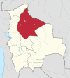
 Beni Department
 (est. 2009)
San Joaquín is a small agricultural town in the Beni Department in the Bolivian lowlands.
It is served by San Joaquín Airport.
History
The Jesuit mission of San Joaquín was founded in 1709.[1] Baure Indians resided at the mission.[2]
Languages
Camba Spanish is the primary vernacular lingua franca spoken in the town. The Joaquiniano dialect of Baure is also spoken in San Joaquín.[3][4]
Location
San Joaquín is the administrative capital of Mamoré Province and is at an elevation of 142 m above sea level. It is just west of the Machupo River, a tributary of the Iténez River.
San Joaquín is 220 kilometres (140 mi) north of Trinidad, the department's capital.
Geography
San Joaquín is located in the Moxos Plains (Llanos de Moxos), at 100,000 km2 one of the greatest wetlands of the Earth. Main vegetation in the area of San Joaquín is the tropical savanna.
Climate
The yearly precipitation of the region is 1,800 mm, with a distinct dry season from May to September. Monthly average temperatures vary from 24 °C und 29 °C over the year.
| Climate data for San Joaquin | |||||||||||||
|---|---|---|---|---|---|---|---|---|---|---|---|---|---|
| Month | Jan | Feb | Mar | Apr | May | Jun | Jul | Aug | Sep | Oct | Nov | Dec | Year |
| Mean daily maximum °C (°F) | 33 (92) | 34 (93) | 34 (94) | 33 (92) | 31 (88) | 34 (93) | 34 (93) | 35 (95) | 36 (97) | 36 (96) | 33 (92) | 33 (91) | 34 (93) |
| Mean daily minimum °C (°F) | 22 (72) | 22 (72) | 22 (72) | 22 (72) | 18 (65) | 19 (67) | 18 (65) | 18 (64) | 20 (68) | 21 (70) | 22 (71) | 23 (73) | 21 (69) |
| Average precipitation mm (inches) | 304.9 (12.00) | 288.7 (11.37) | 273.0 (10.75) | 138.7 (5.46) | 62.2 (2.45) | 26.3 (1.04) | 16.7 (0.66) | 35.1 (1.38) | 79.6 (3.13) | 142.5 (5.61) | 218.6 (8.61) | 295.5 (11.63) | 1,881.8 (74.09) |
| Source: Weatherbase [5] | |||||||||||||
Population
Over the past two decades, the town's population has risen by circa 30%, from 3,489 (census 1992) to 4,094 (census 2001) and 4,589 (2009 estimate).[6] San Joaquin has been the site of a Machupo virus or Bolivian Hemorragic Fever outbreak in the 1960s.
Notable people
- Jeanine Áñez, politician
References
- ^ Block, David (1994). Mission culture on the upper Amazon: native tradition, Jesuit enterprise, and secular policy in Moxos, 1660-1880. Lincoln: University of Nebraska Press. ISBN 0-8032-1232-1..
- ^ Meireles, Denise Maldi. 1989. Guardiães da fronteira: Rio Guaporé, século XVIII. Petrópolis: Vozes. ISBN 85-326-0017-4.
- ^ Danielsen, Swintha (2011). The personal paradigms in Baure and other South Arawakan languages. In Antoine Guillaume; Françoise Rose (eds.). International Journal of American Linguistics 77(4): 495-520.
- ^ Danielsen, Swintha; Terhart, Lena (2014). Paunaka. In Mily Crevels; Pieter Muysken (eds.). Lenguas de Bolivia, vol. III: Oriente, pp. 221-258. La Paz: Plural Editores.
- ^ "Weatherbase: Historical Weather for San Joaquin, Bolivia". Weatherbase. 2011. Retrieved on November 24, 2011.
- ^ World Gazetteer[dead link]
External links
- Detailed map of Mamoré Province
- San Joaquín climate (German)
13°02′29″S 64°40′05″W / 13.04139°S 64.66806°W / -13.04139; -64.66806 (San Ignacio de Moxos)
- v
- t
- e

Capital: La Santísima Trinidad
and seats
- Baures (Baures)
- Exaltación (Exaltación)
- Guayaramerín (Guayaramerín)
- Huacaraje (Huacaraje)
- Loreto (Loreto)
- Magdalena (Magdalena)
- Puerto Siles (Puerto Siles)
- Reyes (Reyes)
- Riberalta (Riberalta)
- Rurrenabaque (Rurrenabaque)
- San Andrés (San Andrés)
- San Borja (San Borja)
- San Ignacio (San Ignacio)
- San Javier (San Javier)
- San Joaquín (San Joaquín)
- San Ramón (San Ramón)
- Santa Ana (Santa Ana del Yacuma)
- Santa Rosa (Santa Rosa)
- Trinidad (Trinidad)
| |||
|---|---|---|---|
| Missions | 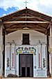 | ||
| Peoples | |||
| Languages |
| ||
| Geography | |||
Authority control databases | |
|---|---|
| International |
|
| National |
|
| Other |
|


