Sawridge 150G
Indian reserve in Sawridge First Nation
Sawridge 150G | |
|---|---|
Indian reserve | |
| Sawridge Indian Reserve No. 150G | |
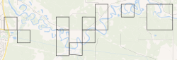 Boundaries of Sawridge 150G | |
 Location in Alberta | |
| First Nation | Sawridge First Nation |
| Treaty | 8 |
| Country | Canada |
| Province | Alberta |
| Municipal district | Lesser Slave River |
| Headquarters | Slave Lake |
| Area | |
| • Total | 9.689 km2 (3.741 sq mi) |
| Population (2016)[2] | |
| • Total | 20 |
| • Density | 2.1/km2 (5.3/sq mi) |
Sawridge 150G is an Indian reserve of the Sawridge First Nation in Alberta, located within the Municipal District of Lesser Slave River No. 124. It is adjacent to the eastern boundary of the town of Slave Lake.
References
- v
- t
- e

Cultural areas: Plains, Subarctic
- Algic / Algonquian
- Athapascan / Dene
- Siouan
- Nakoda
band governments
| Athabasca Tribal Council (Fort McMurray) | |
|---|---|
| Blackfoot Confederacy (Standoff) | |
| Confederacy of Treaty 6 First Nations (Enoch) | |
| Kee Tas Kee Now Tribal Council (Atikameg) | |
| Lesser Slave Lake Indian Regional Council (Slave Lake) | |
| North Peace Tribal Council (High Level) | |
| Stoney Nakoda - Tsuut'ina Tribal Council (Tsuut'ina) | |
| Tribal Chiefs Ventures (Beaver Lake Cree) | |
| Western Cree Tribal Council (Valleyview) | |
| Yellowhead Tribal Council (Morinville) | |
| Unaffiliated | |
| Not federally recognized |
|
| Not headquartered in Alberta |
|
| Terminated |
|


55°17′21″N 114°40′03″W / 55.289065°N 114.667379°W / 55.289065; -114.667379 (Sawridge 150G)
 | This Northern Alberta location article is a stub. You can help Wikipedia by expanding it. |
- v
- t
- e
 | This article about an Indian reserve in Alberta is a stub. You can help Wikipedia by expanding it. |
- v
- t
- e


