Sela pri Zburah
Place in Lower Carniola, Slovenia
45°53′54.11″N 15°13′32.32″E / 45.8983639°N 15.2256444°E / 45.8983639; 15.2256444 Slovenia
 (2002)
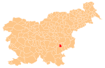
Sela pri Zburah (pronounced [ˈseːla pɾi ˈzbuːɾax]) is a small settlement in the historical region of Lower Carniola in southeastern Slovenia. It belongs to the Municipality of Šmarješke Toplice. The municipality is now included in the Southeast Slovenia Statistical Region.[2]
Name
The name of the settlement was changed from Sela to Sela pri Zburah in 1953.[3]
References
External links
- Sela pri Zburah on Geopedia
- v
- t
- e
Administrative seat: Šmarješke Toplice
| Current |
|
|---|---|
| Former |
|
- Šmarješke Toplice Spa
 | This article about the Municipality of Šmarješke Toplice in Slovenia is a stub. You can help Wikipedia by expanding it. |
- v
- t
- e


