Shire of Cranbrook
Local government area in Western Australia
| Shire of Cranbrook Western Australia | |||||||||||||||
|---|---|---|---|---|---|---|---|---|---|---|---|---|---|---|---|
 Cranbrook shire offices, 2018 | |||||||||||||||
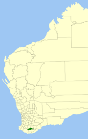 Location in Western Australia | |||||||||||||||
 | |||||||||||||||
| Population | 1,100 (LGA 2021)[1] | ||||||||||||||
| Established | 1926 | ||||||||||||||
| Area | 3,276.8 km2 (1,265.2 sq mi) | ||||||||||||||
| Shire President | George Pollard | ||||||||||||||
| Council seat | Cranbrook | ||||||||||||||
| Region | Great Southern | ||||||||||||||
| State electorate(s) | Roe | ||||||||||||||
| Federal division(s) | O'Connor | ||||||||||||||
| Website | Shire of Cranbrook | ||||||||||||||
| |||||||||||||||
The Shire of Cranbrook is a local government area in the Great Southern region of Western Australia, about 92 kilometres (57 mi) north of Albany and about 320 kilometres (200 mi) south-southeast of the state capital, Perth. The Shire covers an area of 3,277 square kilometres (1,265 sq mi), and its seat of government is the town of Cranbrook.
History
The Cranbrook Road District was gazetted on 14 May 1926 out of parts of the Plantagenet and Tambellup road districts. On 1 July 1961, it became a Shire following changes to the Local Government Act, which reformed all remaining road boards into shires.[2]
Wards
The shire is divided into 3 wards, each with 3 councillors:
- East Ward
- Central Ward
- West Ward
Towns and localities
The towns and localities of the Shire of Cranbrook with population and size figures based on the most recent Australian census:[3][4]
| Locality | Population | Area | Map |
|---|---|---|---|
| Cranbrook | 505 (SAL 2021)[5] | 1,206.7 km2 (465.9 sq mi) |  |
| Frankland River | 353 (SAL 2021)[6][7] | 3.3, 1,391.9 km2 (1.3, 537.4 sq mi) |  |
| Stirling Range National Park * | 0 (SAL 2016)[8][9] | 1,121.3 km2 (432.9 sq mi) |  |
| Tenterden | 240 (SAL 2021)[10] | 414.5 km2 (160.0 sq mi) |  |
- ( * indicates locality is only partially located within this shire)
Heritage-listed places
As of 2023, 35 places are heritage-listed in the Shire of Cranbrook,[11] of which one is on the State Register of Heritage Places, the Tenterden Agricultural Hall, a building destroyed by bush fire on 27 December 2003.[12]
References
- ^ Australian Bureau of Statistics (28 June 2022). "Cranbrook (Local Government Area)". Australian Census 2021 QuickStats. Retrieved 28 June 2022.

- ^ "Municipality Boundary Amendments Register" (PDF). Western Australian Electoral Distribution Commission. Retrieved 11 January 2020.
- ^ "SLIP Map". maps.slip.wa.gov.au. Landgate. Retrieved 4 January 2023.
- ^ "NationalMap". nationalmap.gov.au. Geoscience Australia. Retrieved 4 January 2023.
- ^ Australian Bureau of Statistics (28 June 2022). "Cranbrook (WA) (suburb and locality)". Australian Census 2021 QuickStats. Retrieved 28 June 2022.
- ^ Australian Bureau of Statistics (28 June 2022). "Frankland River (suburb and locality)". Australian Census 2021 QuickStats. Retrieved 7 August 2022.
- ^ Australian Bureau of Statistics (28 June 2022). "Frankland River (suburb and locality)". Australian Census 2021 QuickStats. Retrieved 28 June 2022.
- ^ Australian Bureau of Statistics (27 June 2017). "Stirling Range National Park (suburb and locality)". Australian Census 2016.
- ^ Australian Bureau of Statistics (27 June 2017). "Stirling Range National Park (suburb and locality)". Australian Census 2016 QuickStats. Retrieved 28 June 2022.
- ^ Australian Bureau of Statistics (28 June 2022). "Tenterden (WA) (suburb and locality)". Australian Census 2021 QuickStats. Retrieved 28 June 2022.
- ^ "Shire of Cranbrook Heritage Places". inherit.stateheritage.wa.gov.au. Heritage Council of Western Australia. Retrieved 20 February 2023.
- ^ "Shire of Cranbrook State Register of Heritage Places". inherit.stateheritage.wa.gov.au. Heritage Council of Western Australia. Retrieved 20 February 2023.
External links
- Official website
- v
- t
- e
| Cities | |
|---|---|
| Towns | |
| Shires |
- Beverley
- Brookton
- Bruce Rock
- Chittering
- Corrigin
- Cuballing
- Cunderdin
- Dalwallinu
- Dandaragan
- Dowerin
- Dumbleyung
- Gingin
- Goomalling
- Kellerberrin
- Kondinin
- Koorda
- Kulin
- Lake Grace
- Merredin
- Moora
- Mount Marshall
- Mukinbudin
- Narembeen
- Narrogin
- Northam
- Nungarin
- Pingelly
- Quairading
- Tammin
- Toodyay
- Trayning
- Victoria Plains
- Wagin
- Wandering
- West Arthur
- Westonia
- Wickepin
- Williams
- Wongan–Ballidu
- Wyalkatchem
- Yilgarn
- York
- Christmas Island#
- Cocos (Keeling) Islands#
Authority control databases | |
|---|---|
| International |
|
| National |
|
34°17′49″S 117°33′14″E / 34.297°S 117.554°E / -34.297; 117.554


