Sveta Gora
Place in Slovenian Littoral, Slovenia
Sveta Gora Monte Santo (di Gorizia) | |
|---|---|
 | |
| 45°59′56.16″N 13°39′19.26″E / 45.9989333°N 13.6553500°E / 45.9989333; 13.6553500 | |
| Country |  Slovenia Slovenia |
| Traditional region | Slovenian Littoral |
| Statistical region | Gorizia |
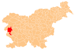
| Municipality | Nova Gorica |
| Area | |
| • Total | 0.3 km2 (0.1 sq mi) |
| Elevation | 681 m (2,234 ft) |
| Population (2013) | |
| • Total | 14 |
| [1] | |
Sveta Gora (pronounced [ˈsʋeːta ˈɡɔːɾa]; Italian: Monte Santo di Gorizia) is a settlement in western Slovenia in the Municipality of Nova Gorica.[2] It encompasses Holy Mount (Slovene: Sveta gora), above the Soča Valley and southwest of the Banjšice Plateau.
History

Bunker exterior

Bunker interior
World War One bunkers
In 1539 Uršula Ferligoj, a shepherd from Grgar, had a vision in which the Virgin Mary commanded her to tell the people to build her a church.[3]
In May 1917 Sveta Gora was the scene of heavy fighting between Austrian and Italian forces.[citation needed] Several Austro-Hungarian bunkers are found along Skalnica Road (Skalniška cesta) leading to the Franciscan monastery and church at the top of Mount Skalnica (681 meters or 2,234 feet). Sveta Gora became an independent settlement in 2006, when its territory was administratively separated from the territory of Solkan and Grgar.[1]
References
External links
- Sveta Gora on Geopedia
- v
- t
- e
Administrative seat: Nova Gorica
| Current |
|
|---|---|
| Former |
|
- Nevin Birsa
- Valter Birsa
- Matej Bor
- Jure Franko
- Ivo Hvalica
- Klement Jug
- Boris Kalin
- Zdenko Kalin
- Vasja Klavora
- Danilo Kovačič
- Janko Kralj
- Branko Marušič
- Tomaž Marušič
- Iztok Mlakar
- Dušan Pirjevec Ahac
- Marko Anton Plenčič
- Vojteh Ravnikar
- Gianni Rijavec
- Leon Rupnik
- Igor Simčič
- Mojca Širok
- Stanislav Škrabec
- Josip Srebrnič
- Jože Srebrnič
- Boštjan Vuga
- Danilo Zavrtanik
- Vasilij Žbogar
 | This article about the Municipality of Nova Gorica in Slovenia is a stub. You can help Wikipedia by expanding it. |
- v
- t
- e


