Tekes County
County in Xinjiang, China
Tekes County تېكەس ناھىيىسى (Uyghur) تەكەس اۋدانى (Kazakh) 特克斯县 (Chinese) | |
|---|---|
County | |
 A herdsman in Tekes County | |
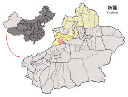 Tekes County (red) within Ili Prefecture (yellow) and Xinjiang | |
43°12′49″N 81°50′14″E / 43.2137°N 81.8371°E / 43.2137; 81.8371 | |
| Country | China |
| Autonomous region | Xinjiang |
| Autonomous prefecture | Ili |
| County seat | Tekes Town |
| Area | |
| • Total | 8,066.45 km2 (3,114.47 sq mi) |
| Population (2020)[1] | |
| • Total | 148,945 |
| • Density | 18/km2 (48/sq mi) |
| Time zone | UTC+8 (China Standard[a]) |
| Website | www |
| Tekes County | |||||||||||
|---|---|---|---|---|---|---|---|---|---|---|---|
| Chinese name | |||||||||||
| Simplified Chinese | 特克斯县 | ||||||||||
| Traditional Chinese | 特克斯縣 | ||||||||||
| |||||||||||
| Mongolian name | |||||||||||
| Mongolian Cyrillic | Такас шиан | ||||||||||
| Mongolian script | تېكەس ناھىيىسى | ||||||||||
| |||||||||||
| Kazakh name | |||||||||||
| Kazakh | تەكەس اۋدانى Текес ауданы Tekes aýdany | ||||||||||
Tekes County is a county within the Xinjiang Uyghur Autonomous Region and is under the administration of the Ili Kazakh Autonomous Prefecture. It contains an area of 8,067 km2. According to the 2002 census, it has a population of 150,000.
The county center is known for being a planned community with a shape of a ba gua.[2]
Administrative divisions
Tekes County is divided into 5 towns, 1 township, and 2 ethnic townships.[3]
| Name | Simplified Chinese | Hanyu Pinyin | Uyghur (UEY) | Uyghur Latin (ULY) | Kazakh (Arabic script) | Kazakh (Cyrillic script) | Administrative division code | Notes |
|---|---|---|---|---|---|---|---|---|
| Towns | ||||||||
| Tekes Town | 特克斯镇 | Tèkèsī Zhèn | تېكەس بازىرى | tëkes baziri | تەكەس قالاشىعى | Текес қалашығы | 654027100 | |
| Cholaqtërek Town | 乔拉克铁热克镇 | Qiáolākètiěrèkè Zhèn | چولاقتېرەك بازىرى | cholaqtërek baziri | شولاقتەرەك قالاشىعى | Шолақтерек қалашығы | 654027101 | |
| Qaradala Town | 喀拉达拉镇 | Kālādálā Zhèn | قارادالا بازىرى | qaradala baziri | قارادالا قالاشىعى | Қарадала қалашығы | 654027102 | |
| Chil'özek Town | 齐勒乌泽克镇 | Qílèwūzékè Zhèn | چىلئۆزەك بازىرى | chil'özek baziri | شيلىوزەك قالاشىعى | Шиліөзек қалашығы | 654027104 | |
| Qaratoqay Town | 喀拉托海镇 | Kālātuōhǎi Zhèn | قاراتوقاي بازىرى | qaratoqay baziri | قاراتوعاي قالاشىعى | Қаратоғай қалашығы | 654027104 | |
| Township | ||||||||
| Köksu Township | 阔克苏乡 | Kuòkèsū Xiāng | كۆكسۇ يېزىسى | köksu yëzisi | كوكسۋ اۋىلى | Көксу ауылы | 654027201 | |
| Ethnic Township | ||||||||
| Xujirti Mongol Ethnic Township | 呼吉尔特蒙古民族乡 | Hūjí'ěrtè Ménggǔ Mínzúxiāng | خۇجىرتى موڭغۇل يېزىسى | xujirti mongghul yëzisi | حۇجىرتى موڭعۇل ۇلتتىق اۋىلى | Хұжырты Моңғұл Ұлттық ауылы | 654027200 | (Mongolian) ᠬᠤᠵᠢᠷᠲᠤ ᠮᠣᠩᠭᠣᠯ ᠦᠨᠳᠦᠰᠦᠲᠡᠨ ᠤ ᠰᠤᠮᠤᠨ Хужирт монгол үндэстэний суман |
| Köktërek Kyrgyz Ethnic Township | 阔克铁热克柯尔克孜民族乡 | Kuòkètiěrèkè Kē'ěrkèzī Mínzúxiāng | كۆكتېرەك قىرغىز يېزىسى | köktërek qirghiz yëzisi | كوكتەرەك قىرعىز ۇلتتىق اۋىلى | Көктерек қырғыз ұлттық ауылы | 654027203 | (Kyrgyz) كۅكتەرەك قىرعىز ۇلۇتتۇق ايىلى көктерек кыргыз улуттук айылы |
- Others:
- Tekes County Horse Herding Pasture (特克斯县马场)
- Koksu Tree Farm (科克苏林场)
- 78th Regiment of the XPCC (兵团七十八团) (78-تۇەن مەيدانى) (78-تۋان الاڭىنداعى)
Climate
| Climate data for Tekes, elevation 1,210 m (3,970 ft), (1991–2020 normals) | |||||||||||||
|---|---|---|---|---|---|---|---|---|---|---|---|---|---|
| Month | Jan | Feb | Mar | Apr | May | Jun | Jul | Aug | Sep | Oct | Nov | Dec | Year |
| Mean daily maximum °C (°F) | −3.0 (26.6) | 0.4 (32.7) | 8.6 (47.5) | 17.8 (64.0) | 21.9 (71.4) | 25.2 (77.4) | 27.3 (81.1) | 27.1 (80.8) | 23.1 (73.6) | 15.9 (60.6) | 6.7 (44.1) | −0.8 (30.6) | 14.2 (57.5) |
| Daily mean °C (°F) | −9.7 (14.5) | −6.1 (21.0) | 1.9 (35.4) | 10.1 (50.2) | 14.5 (58.1) | 17.8 (64.0) | 19.5 (67.1) | 18.8 (65.8) | 14.7 (58.5) | 7.7 (45.9) | 0.1 (32.2) | −6.9 (19.6) | 6.9 (44.4) |
| Mean daily minimum °C (°F) | −14.3 (6.3) | −10.9 (12.4) | −3.2 (26.2) | 4.0 (39.2) | 8.3 (46.9) | 11.6 (52.9) | 13.1 (55.6) | 12.0 (53.6) | 7.8 (46.0) | 1.9 (35.4) | −4.2 (24.4) | −10.9 (12.4) | 1.3 (34.3) |
| Average precipitation mm (inches) | 8.1 (0.32) | 8.0 (0.31) | 18.1 (0.71) | 46.5 (1.83) | 64.5 (2.54) | 75.8 (2.98) | 67.9 (2.67) | 51.3 (2.02) | 34.8 (1.37) | 26.3 (1.04) | 18.8 (0.74) | 9.8 (0.39) | 429.9 (16.92) |
| Average precipitation days (≥ 0.1 mm) | 5.4 | 5.8 | 7.3 | 10.2 | 12.9 | 14.6 | 14.6 | 12.3 | 8.3 | 7.1 | 7.1 | 6.1 | 111.7 |
| Average snowy days | 8.1 | 9.4 | 6.7 | 2.1 | 0.4 | 0 | 0 | 0 | 0.1 | 2.4 | 7.1 | 9.4 | 45.7 |
| Average relative humidity (%) | 69 | 69 | 67 | 60 | 60 | 64 | 63 | 61 | 59 | 65 | 71 | 71 | 65 |
| Mean monthly sunshine hours | 162.7 | 168.3 | 208.7 | 232.2 | 260.8 | 256.9 | 281.8 | 279.1 | 251.8 | 217.0 | 152.2 | 141.3 | 2,612.8 |
| Percent possible sunshine | 55 | 56 | 56 | 57 | 57 | 56 | 61 | 66 | 69 | 65 | 53 | 51 | 59 |
| Source: China Meteorological Administration[4][5] | |||||||||||||
Demographics
Notes
- ^ Locals in Xinjiang frequently observe UTC+6 (Xinjiang Time), 2 hours behind Beijing.
References
- ^ Xinjiang: Prefectures, Cities, Districts and Counties
- ^ Sun, Yaping (孙亚萍) (2010-11-24). 新疆八卦城,丘处机定雏形 [Xinjiang Ba Gua City, the Rudiment Established by Qiu Chuji] (in Simplified Chinese). 国际在线. Retrieved 16 October 2012. Archived: Internet Archive link of 01.08.2020
- ^ 2022年统计用区划代码和城乡划分代码:特克斯县. National Bureau of Statistics of China.
- ^ 中国气象数据网 – WeatherBk Data (in Simplified Chinese). China Meteorological Administration. Retrieved 10 October 2023.
- ^ 中国气象数据网 (in Simplified Chinese). China Meteorological Administration. Retrieved 10 October 2023.
- ^ 3-7 各地、州、市、县(市)分民族人口数 [3-7 Population by Nationality by Prefecture, State, City and County (City)]. tjj.xinjiang.gov.cn (in Chinese). Statistical Bureau of Xinjiang Uyghur Autonomous Region. 2020-06-10. Archived from the original on 2020-11-01. Retrieved 2023-11-18.
- v
- t
- e
| Ürümqi | |
|---|---|
| Karamay | |
| Turpan | |
| Kumul / Hami |
autonomous prefecture
| Ili Kazakh |
| ||||||
|---|---|---|---|---|---|---|---|
| Aksu | |
|---|---|
| Kashgar / Kashi | |
| Hotan / Hetian |
prefectures
| Changji Hui | |
|---|---|
| Bortala Mongol |
|
| Bayingholin Mongol | |
| Kizilsu Kyrgyz |
| County-level cities |
|---|
- 1 Tacheng and Altay are prefectures within and under the administration of the Ili Prefecture.
- Ethnic minority autonomous areas
- Dong
- Hui
- Korean
- Manchu
- Miao
- Mongol
- Tibetan
- Tujia
- Uyghur
- Yao
- Yi
- Zhuang
- Others
 | This Xinjiang location article is a stub. You can help Wikipedia by expanding it. |
- v
- t
- e


