Ternat
Municipality in Flemish Community, Belgium

Flag

Coat of arms
Location of Ternat


Ternat
Location in Belgium 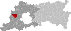
Location of Ternat in Flemish Brabant

 Belgium
 (2018-01-01)[1]
1740-1742
23086
Ternat (Dutch pronunciation: [tɛrˈnɑt]; also French: Ternath) is a municipality located in the Belgian province of Flemish Brabant. The municipality comprises the villages of Sint-Katherina-Lombeek, Ternat proper and Wambeek. It is also situated in the Pajottenland. On January 1, 2018 Ternat had a total population of 15.481. The total area is 24.48 km2 which gives a population density of 597 inhabitants per km2.
The village of Ternat is the site of a medieval sandstone church and the 12th-century Kruikenburg Castle, extensively remodelled in the 17th century.[2] The local authority offices are housed in an 18th-century mansion.[3]
Notable people
- Everard t'Serclaes (c.1320–1388)
References
External links
 Media related to Ternat at Wikimedia Commons


- v
- t
- e
- Affligem
- Asse
- Beersel
- Bever
- Dilbeek
- Drogenbos
- Galmaarden
- Gooik
- Grimbergen
- Halle
- Herne
- Hoeilaart
- Kampenhout
- Kapelle-op-den-Bos
- Kraainem
- Lennik
- Liedekerke
- Linkebeek
- Londerzeel
- Machelen
- Meise
- Merchtem
- Opwijk
- Overijse
- Pepingen
- Roosdaal
- Sint-Genesius-Rode
- Sint-Pieters-Leeuw
- Steenokkerzeel
- Ternat
- Vilvoorde
- Wemmel
- Wezembeek-Oppem
- Zaventem
- Zemst

- Bold indicates cities
- Italic indicates municipalities with language facilities
Authority control databases | |
|---|---|
| International |
|
| National |
|
| Geographic |
|
 | This Flemish Brabant location article is a stub. You can help Wikipedia by expanding it. |
- v
- t
- e


