Trnava District
District in Trnava Region, Slovakia
Trnava District | |
|---|---|
District | |
 | |
 | |
| Country | Slovakia |
| Region (kraj) | Trnava Region |
| Area | |
| • Total | 741 km2 (286 sq mi) |
| Population (2001) | |
| • Total | 126,864 |
| • Density | 170/km2 (440/sq mi) |
| Time zone | UTC+01:00 (CET) |
| • Summer (DST) | UTC+02:00 (CEST) |
| Telephone prefix | 33 |
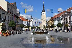
Trnava District (Slovak: okres Trnava) is a district in the Trnava Region of Slovakia.[1] In its present borders the district was established in 1996. Before that date Hlohovec district was a part of it. It comprises the villages around Trnava, which forms an administrative, cultural and economy center of the district. The towns and villages are partly bedroom communities for the people who work in Trnava or Bratislava.
Municipalities
- Biely Kostol
- Bíňovce
- Bohdanovce nad Trnavou
- Boleráz
- Borová
- Brestovany
- Bučany
- Buková
- Cífer
- Dechtice
- Dlhá
- Dobrá Voda
- Dolná Krupá
- Dolné Dubové
- Dolné Lovčice
- Dolné Orešany
- Horná Krupá
- Horné Dubové
- Horné Orešany
- Hrnčiarovce nad Parnou
- Jaslovské Bohunice
- Kátlovce
- Košolná
- Križovany nad Dudváhom
- Lošonec
- Majcichov
- Malženice
- Naháč
- Opoj
- Pavlice
- Radošovce
- Ružindol
- Slovenská Nová Ves
- Smolenice
- Suchá nad Parnou
- Šelpice
- Špačince
- Šúrovce
- Trnava
- Trstín
- Vlčkovce
- Voderady
- Zavar
- Zeleneč
- Zvončín
References
- ^ "Okres Trnava - Trnavský kraj - E-OBCE.sk".


48°22′25″N 17°35′42″E / 48.37361°N 17.59500°E / 48.37361; 17.59500
Authority control databases | |
|---|---|
| International |
|
| National |
|
 | This Trnava Region geography article is a stub. You can help Wikipedia by expanding it. |
- v
- t
- e


