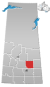
Wadena, Saskatchewan

 Hwy 5 / Hwy 35
Wadena (/wəˈdiːnə/ wə-DEE-nə) is a town in the Canadian province of Saskatchewan, located east of Saskatoon, north of Fort Qu'Appelle and northwest of Yorkton on the eastern shore of the Quill Lakes. The town is known for its birdwatching and hunting opportunities as Quill Lakes is part of a major flight path. The Wadena and District Museum, located just south of Wadena on Highway 35, also hosts an annual Vintage Day in July.
Wadena is the administrative centre of the Rural Municipality of Lakeview. It is also the administrative headquarters of the Fishing Lake First Nation band government.[5]
The town is named after Wadena, Minnesota, the place of origin of some early settlers of Scandinavian American descent.[6] The town in Minnesota was in turn named after a Chippewa/Saulteaux Chief.
Demographics
In the 2011 Canada Census conducted by Statistics Canada, Wadena's population was 1,306[7] living within 2.91 square kilometers (1.12 square miles), for a population density of 449.5/km2 (1,166.8/sq mi).[7]
In the 2021 Census of Population conducted by Statistics Canada, Wadena had a population of 1,269 living in 606 of its 677 total private dwellings, a change of -1.5% from its 2016 population of 1,288. With a land area of 2.99 km2 (1.15 sq mi), it had a population density of 424.4/km2 (1,099.2/sq mi) in 2021.[1]
Notable people
- Pamela Wallin[8] – Canadian radio and television personality, senator
- Keith Magnuson[9] – player, team captain and coach of the NHL's Chicago Black Hawks, born and grew up in Wadena
- General Wayne Eyre[10]
- Leonard Lee – founder of Lee Valley Tools
See also
- List of communities in Saskatchewan
- List of place names in Canada of Indigenous origin
- List of towns in Saskatchewan
References
- ^ a b c "Population and dwelling counts: Canada, provinces and territories, census divisions and census subdivisions (municipalities), Saskatchewan". Statistics Canada. February 9, 2022. Retrieved April 1, 2022.
- ^ National Archives, Archivia Net, Post Offices and Postmasters
- ^ Government of Saskatchewan, MRD Home, Municipal Directory System (Towns), retrieved 2008-10-28
- ^ Commissioner of Canada Elections, Library of Parliament (2008), Riding history for Yorkton—Melville (1966– ), retrieved 2008-10-28
- ^ Fishing Lake First Nation
- ^ David McLennan. "Wadena". Encyclopedia of Saskatchewan. Canadian Plains Research Center. Retrieved 22 September 2017.
- ^ a b "Canada Census 2011 (Community Profiles)". 8 February 2012. Retrieved September 1, 2012.
- ^ Sanderson, Anne (January 7, 2009). "Wallin attends first meeting as Canadian Senator". Wadena News. p. 1.
- ^ "Keith Magnuson".
- ^ "Deputy Commander UNC". Retrieved July 1, 2019.
- Sanderson, Anne (September 26, 2012). "Nominations close for area municipalities". Wadena News. p. 1.
- Wadena News Staff (August 1, 2012). "Welcome home!". Wadena News. p. 1.
External links
- Official website
- v
- t
- e
- Aberdeen
- Abernethy
- Alameda
- Allan
- Arborfield
- Arcola
- Asquith
- Assiniboia
- Balcarres
- Balgonie
- Battleford
- Bengough
- Bienfait
- Big River
- Biggar
- Birch Hills
- Blaine Lake
- Bredenbury
- Broadview
- Bruno
- Burstall
- Cabri
- Canora
- Carlyle
- Carnduff
- Carrot River
- Central Butte
- Choiceland
- Churchbridge
- Colonsay
- Coronach
- Craik
- Creighton
- Cudworth
- Cupar
- Cut Knife
- Dalmeny
- Davidson
- Delisle
- Duck Lake
- Dundurn
- Eastend
- Eatonia
- Elrose
- Esterhazy
- Eston
- Fleming
- Foam Lake
- Fort Qu'Appelle
- Francis
- Govan
- Gravelbourg
- Grenfell
- Gull Lake
- Hafford
- Hague
- Hanley
- Herbert
- Hudson Bay
- Imperial
- Indian Head
- Ituna
- Kamsack
- Kelvington
- Kerrobert
- Kindersley
- Kinistino
- Kipling
- Kyle
- La Ronge
- Lafleche
- Lampman
- Langenburg
- Langham
- Lanigan
- Lashburn
- Leader
- Lemberg
- Leroy
- Lumsden
- Luseland
- Macklin
- Maidstone
- Maple Creek
- Marshall
- Midale
- Milestone
- Moosomin
- Morse
- Mossbank
- Naicam
- Nipawin
- Nokomis
- Norquay
- Ogema
- Osler
- Outlook
- Oxbow
- Pilot Butte
- Ponteix
- Porcupine Plain
- Preeceville
- Qu'Appelle
- Radisson
- Radville
- Raymore
- Redvers
- Regina Beach
- Rocanville
- Rockglen
- Rose Valley
- Rosetown
- Rosthern
- Rouleau
- St. Brieux
- St. Walburg
- Saltcoats
- Scott
- Shaunavon
- Shellbrook
- Sintaluta
- Southey
- Spiritwood
- Springside
- Star City
- Storthoaks
- Stoughton
- Strasbourg
- Sturgis
- Tisdale
- Turtleford
- Unity
- Vonda
- Wadena
- Wakaw
- Waldheim
- Wapella
- Watrous
- Watson
- Wawota
- White City
- Whitewood
- Wilkie
- Willow Bunch
- Wolseley
- Wynyard
- Yellow Grass
- Zealandia
- Culture
- Economy
- First Nations
- Geography
- Government
- History
- Regions
- Tourist attractions
 Category
 Canada portal
 WikiProject
51°56′45″N 103°48′05″W / 51.94583°N 103.80139°W / 51.94583; -103.80139 (Wadena, Saskatchewan)


