Watlington, Norfolk
Human settlement in England
- Watlington
- Norfolk
- East
Watlington is a village, civil parish and electoral ward in the English county of Norfolk. It covers an area of 6.93 km2 (2.68 sq mi) and had a population of 2,031 in 852 households at the 2001 census,[1] the population increasing to 2,455 at the 2011 Census.[2] It is in the district of King's Lynn and West Norfolk.
The villages name means 'farm/settlement of Hwaetel's/Wacol's people' or perhaps, 'farm/settlement at Wateling (= Wattle/thatching place)'.[3]
It is situated some 1.2 mi (1.9 km) from the east bank of the River Great Ouse, 7.5 mi (12.1 km) south of the town of King's Lynn and 37 mi (60 km) west of the city of Norwich.[4]
The village is directly served by Watlington railway station (on the Fen Line between Cambridge and King's Lynn) which is situated 0.62 mi (1.00 km) from the centre of the village. Amenities in the village include a public house, Post Office and medical centre with pharmacy. There is also a sports and social club, village hall and church to the north east of the village.
A small nature reserve named 'Watatunga' opened to visitors in July 2020, offering guided buggy tours amongst '170 acres of woodland, grassland and lakes'. This occupies a vast area directly situated between Watlington and the nearby A10 trunk road.[5]
Notes
- ^ Census population and household counts for unparished urban areas and all parishes Archived 2017-02-11 at the Wayback Machine. Office for National Statistics & Norfolk County Council (2001). Retrieved 20 June 2009.
- ^ "Parish/Ward population 2011". Retrieved 30 August 2015.
- ^ "Key to English Place-names".
- ^ Ordnance Survey (1999). OS Explorer Map 236 - King's Lynn, Downham Market & Swaffham. ISBN 0-319-21867-8.
- ^ "Guided Tours". Watatunga. 11 February 2020. Retrieved 30 July 2020.
References
- ^ Office for National Statistics & Norfolk County Council (2001). Census population and household counts for unparished urban areas and all parishes. Retrieved 2 December 2005.
Gallery
-
 Watlington's village sign.
 -
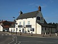 The Angel pub
 -
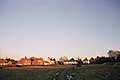 Millennium Green (also known as Angel Field)
 -
 Watlington railway station in 2005.


External links
- Watlington village website
 Media related to Watlington, Norfolk at Wikimedia Commons
- Map sources for Watlington, Norfolk.
- Information from Genuki Norfolk on Watlington.
- v
- t
- e
- Anmer
- Bagthorpe with Barmer
- Barton Bendish
- Barwick
- Bawsey
- Bircham
- Boughton
- Brancaster
- Burnham Market
- Burnham Norton
- Burnham Overy
- Burnham Thorpe
- Castle Acre
- Castle Rising
- Choseley
- Clenchwarton
- Congham
- Crimplesham
- Denver
- Dersingham
- Docking
- Downham Market
- Downham West
- East Rudham
- East Walton
- East Winch
- Emneth
- Feltwell
- Fincham
- Flitcham with Appleton
- Fordham
- Fring
- Gayton
- Great Massingham
- Grimston
- Harpley
- Heacham
- Hilgay
- Hillington
- Hockwold cum Wilton
- Holme-next-the-Sea
- Houghton
- Hunstanton
- Ingoldisthorpe
- Leziate
- Little Massingham
- Marham
- Marshland St James
- Methwold
- Middleton
- Nordelph
- North Creake
- North Runcton
- Northwold
- North Wootton
- Old Hunstanton
- Outwell
- Pentney
- Ringstead
- Roydon
- Runcton Holme
- Ryston
- Sandringham
- Sedgeford
- Shernborne
- Shouldham
- Shouldham Thorpe
- Snettisham
- South Creake
- Southery
- South Wootton
- Stanhoe
- Stoke Ferry
- Stow Bardolph
- Stradsett
- Syderstone
- Terrington St Clement
- Terrington St John
- Thornham
- Tilney All Saints
- Tilney St Lawrence
- Titchwell
- Tottenhill
- Upwell
- Walpole
- Walpole Cross Keys
- Walpole Highway
- Walsoken
- Watlington
- Welney
- Wereham
- West Acre
- West Dereham
- West Rudham
- West Walton
- West Winch
- Wiggenhall St Germans
- Wiggenhall St Mary Magdalen
- Wimbotsham
- Wormegay
- Wretton
 | This Norfolk location article is a stub. You can help Wikipedia by expanding it. |
- v
- t
- e


