Somerset
Somerset


| Sijainti | Lounais-Englanti Englanti Yhdistynyt kuningaskunta |
|---|---|
| Pääkaupunki | Taunton (en)  |
| Pinta-ala | 4 170 km2 () |
| Hallinnolliset osat | Bath ja North East Somerset (d) Somerset (d) (käännä suomeksi) North Somerset (d) |
| Väkiluku | 976 000 as. () |
| Asukastiheys | 234 as./km2 () |
| NUTS | UKK23 |
| Verkkosivusto | www.somerset.gov.uk |

| Koordinaatit | 51° 18′ P, 3° 00′ L |
|---|
muokkaa - muokkaa wikitekstiä - muokkaa Wikidataa
![]()
Somerset on hallinnollinen, muodollinen ja historiallinen kreivikunta Lounais-Englannissa. Hallinnolliseen kreivikuntaan kuuluu viisi hallintopiiriä ja sen keskuksena toimii Tauntonin kaupunki; muodolliseen kreivikuntaan luetaan lisäksi kreivikunnan hallinnosta riippumattomat yhtenäishallintopiirit Bath and North East Somerset ja North Somerset.[1] Vuonna 2020 muodollisen kreivikunnan alueella arvioitiin elävän noin 976 000 ihmistä.[2]
Somerset on alankojen, rotkolaaksojen ja kukkuloiden muodostamaa maalaismaisemaa. Exmoorin nummien kansallispuisto ulottuu Somersetistä Devonin puolelle.[3]
Hallinto
Somersetin muodollisen kreivikunnan alueella sijaitsevat seuraavat hallinnolliset alueet:[2]
| Hallinnon taso | Väkiluku (2020) | Lähde | Kartalla | |
|---|---|---|---|---|
| Somersetin kreivikunta: | 564 000 | [2] | 1–4 | |
| South Somersetin hallintopiiri * | 169 000 | [2] | 1 | |
| Somerset West and Tauntonin hallintopiiri * | 155 000 | [2] | 2 | |
| Sedgemoorin hallintopiiri * | 123 000 | [2] | 3 | |
| Mendipin hallintopiiri * | 116 000 | [2] | 4 | |
| Bath and North East Somerset ** | 196 000 | [2] | 5 | |
| North Somerset ** | 216 000 | [2] | 6 | |
| * Hallintopiiri ** Yhtenäishallintopiiri | ||||
Somersetin aluehallinto

1. taso: Hallintopiirit
2. taso: Kunnat
Väestö
Vuonna 2020 Somersetin muodollisessa kreivikunnassa oli noin 976 000 asukasta ja seuraavat yli kymmenentuhannen asukkaan asutuskeskukset:[2]
| Asutuskeskus | Hallinnollinen alue | Väkiluku (2020) | Lähde |
|---|---|---|---|
| Bath | Bath and North East Somerset | 106 000 | [4] |
| Weston-super-Mare | North Somerset | 88 000 | [5] |
| Taunton | Somerset West and Taunton | 64 000 | [6] |
| Yeovil | South Somerset | 49 000 | [6] |
| Bridgwater | Sedgemoor | 45 000 | [6] |
| Frome | Mendip | 28 000 | [6] |
| Portishead | North Somerset | 27 000 | [5] |
| Burnham-on-Sea | Sedgemoor | 24 000 | [6] |
| Clevedon | North Somerset | 21 000 | [5] |
| Keynsham | Bath and North East Somerset | 19 000 | [4] |
| Nailsea | North Somerset | 16 000 | [5] |
| Midsomer Norton | Bath and North East Somerset | 14 000 | [4] |
| Chard | South Somerset | 14 000 | [6] |
| Street | Mendip | 14 000 | [6] |
| Wellington | Somerset West and Taunton | 13 000 | [6] |
| Minehead | Somerset West and Taunton | 12 000 | [6] |
| Wells | Mendip | 11 000 | [6] |
| Shepton Mallet | Mendip | 11 000 | [6] |
| Radstock | Bath and North East Somerset | 10 000 | [4] |
Tunnukset
Nimikkokukka
Vuonna 2004 Somersetin nimikkokukaksi valittiin vuorineilikka Plantlife International -järjestön pitämässä yleisöäänestyksessä.[7]
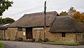
Kuvia
-
 Stantonin kivikehä
 -
 Perry's Cider Dowlish Wake -kylässä
 -
 Somerset Place, Bath


Lähteet
- ↑ Somerset Encyclopaedia Britannica. Viitattu 17.5.2022. (englanniksi)
- ↑ a b c d e f g h i j Brinkhoff, Thomas: United Kingdom: Administrative Division (Counties and Districts) - Population Statistics, Charts and Map City Population. Viitattu 17.5.2022. (englanniksi)
- ↑ Visit Exmoor
- ↑ a b c d Brinkhoff, Thomas: Bath and North East Somerset (Unitary District, South West England, United Kingdom) - Population Statistics, Charts, Map and Location City Population. Viitattu 17.5.2022. (englanniksi)
- ↑ a b c d Brinkhoff, Thomas: North Somerset (Unitary District, South West England, United Kingdom) - Population Statistics, Charts, Map and Location City Population. Viitattu 17.5.2022. (englanniksi)
- ↑ a b c d e f g h i j k Brinkhoff, Thomas: Somerset (County, South West England, United Kingdom) - Population Statistics, Charts, Map and Location City Population. Viitattu 17.5.2022. (englanniksi)
- ↑ Kirby, Alex: UK counties choose floral emblems 5.5.2004. BBC News. Viitattu 17.5.2022. (englanniksi)
Aiheesta muualla
 Kuvia tai muita tiedostoja aiheesta Somerset Wikimedia Commonsissa
Lounais-Englannin hallintopiirit
| Bristol | |
|---|---|
| Cornwall | |
| Devon | East Devon • Exeter • Mid Devon • North Devon • Plymouth • South Hams • Teignbridge • Torbay • Torridge • West Devon |
| Dorset | Bournemouth, Christchurch and Poole • Dorset |
| Gloucestershire | Cheltenham • Cotswold • Forest of Dean • Gloucester • South Gloucestershire • Stroud • Tewkesbury |
| Somerset | Bath and North East Somerset • Mendip • North Somerset • Sedgemoor • South Somerset • Taunton Deane • West Somerset |
| Wiltshire |


