Gefrees
| Gefrees città | |
|---|---|
 | |
 | |
| Localizzazione | |
| Stato |  Germania Germania |
| Land |  Baviera Baviera |
| Distretto |  Alta Franconia Alta Franconia |
| Circondario | Bayreuth |
| Territorio | |
| Coordinate | 50°05′43″N 11°44′23″E50°05′43″N, 11°44′23″E |
| Altitudine | 500 m s.l.m. |
| Superficie | 50,32 km² |
| Abitanti | 4 264[1] (31-12-2022) |
| Densità | 84,74 ab./km² |
| Altre informazioni | |
| Cod. postale | 95482 |
| Prefisso | 09254 |
| Fuso orario | UTC+1 |
| Codice Destatis | 09 4 72 139 |
| Cartografia | |
  Gefrees | |
| Sito istituzionale | |
| Modifica dati su Wikidata · Manuale | |
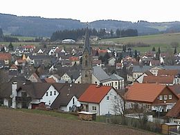
Gefrees è una città tedesca situata nel land della Baviera.
Note
- ^ Ente statistico della Baviera - Dati sulla popolazione
Altri progetti
Altri progetti
- Wikimedia Commons
 Wikimedia Commons contiene immagini o altri file su Gefrees
Collegamenti esterni
- Sito ufficiale, su gefrees.de.


V · D · M Comuni del circondario di Bayreuth  | |
|---|---|
| Città | Bad Berneck im Fichtelgebirge · Betzenstein · Creußen · Gefrees · Goldkronach · Hollfeld · Pegnitz · Pottenstein · Waischenfeld |
| Comuni | Ahorntal · Aufseß · Bindlach · Bischofsgrün · Eckersdorf · Emtmannsberg · Fichtelberg · Gesees · Glashütten · Haag · Heinersreuth · Hummeltal · Kirchenpingarten · Mehlmeisel · Mistelbach · Mistelgau · Plankenfels · Plech · Prebitz · Schnabelwaid · Seybothenreuth · Speichersdorf · Warmensteinach · Weidenberg |
| Controllo di autorità | VIAF (EN) 140223758 · GND (DE) 4086684-1 |
|---|
 Portale Germania: accedi alle voci di Wikipedia che parlano della Germania


