Hrabstwo Franklin (Vermont)
| hrabstwo | |||
 | |||
| Państwo |
| ||
|---|---|---|---|
| Stan |
| ||
| Siedziba | St. Albans | ||
| Kod statystyczny | FIPS 6-4: 50 011 | ||
| Powierzchnia | 1792,32 km²[1] | ||
| Populacja (2009) • liczba ludności |
| ||
Położenie na mapie Vermont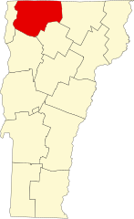 | |||
| 44°51′36″N 72°54′36″W/44,860000 -72,910000 | |||
| |||


Hrabstwo Franklin (ang. Franklin County) – hrabstwo w stanie Vermont w Stanach Zjednoczonych. Obszar całkowity hrabstwa obejmuje powierzchnię 692,02 mil² (1792,32 km²). Według szacunków United States Census Bureau w roku 2009 miało 47 746 mieszkańców[2].
Hrabstwo powstało w 1792 roku[3].
Miasta (city)
- St. Albans
Gminy (town)
- Bakersfield
- Berkshire
- Enosburgh
- Fairfax
- Fairfield
- Fletcher
- Franklin
- Georgia
- Highgate
- Montgomery
- Richford
- Sheldon
- St. Albans
- Swanton[4]
CDP
- Richford[4]
Wsie
- Enosburg Falls
- Swanton[4]
| Populacja hrabstwa w poprzednich latach[3] | |
|---|---|
| Rok | Liczba ludności |
| 1980 | 34 800 |
| 1990 | 39 980 |
| 2000 | 45 417 |
| 2005 | 47 914 |
Przypisy
- ↑ US Census Bureau: Population, Housing Units, Area, and Density: 2000. [dostęp 2012-05-26]. [zarchiwizowane z tego adresu (2016-03-09)]. (ang.).
- ↑ a b US Census Bureau: Franklin County. Quickfacts. [dostęp 2011-07-16]. (ang.).
- ↑ a b National Association of Counties: Franklin County, VT. [dostęp 2011-07-16]. (ang.).
- ↑ a b c National Association of Counties: Places in Franklin County, VT. [dostęp 2011-07-16]. (ang.).
- p
- d
- e

Kontrola autorytatywna (hrabstwo w stanie Vermont):
- Britannica: place/Franklin-county-Vermont


