Harmony Point
Headland of Antarctica
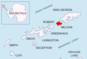
Harmony Point is a point which lies close west of Harmony Cove and forms both the south side of the entrance to Malak Sechko Cove and the western extremity of Guangzhou Peninsula and Nelson Island, in the South Shetland Islands of Antarctica. It was charted in 1935 by Discovery Investigations personnel on the Discovery II, and named from association with Harmony Cove.[1]
Important Bird Area
The 3,069 ha[2] area comprising the ice-free points Harmony and The Toe, together with their ice-covered vicinity has been identified as an Important Bird Area (IBA) by BirdLife International because it supports a variety of breeding birds, including one of the largest chinstrap penguin bird colonies on the Antarctic Peninsula with around 90,000 pairs. Other birds nesting at the site are gentoo penguins (3300 pairs), imperial shags (45 pairs), Wilson's and black-bellied storm petrels (1000 pairs combined), southern giant petrels (485 pairs), Cape petrels (480 pairs), Antarctic skuas (60 pairs), snowy sheathbills (140 pairs), kelp gulls (130 pairs) and Antarctic terns (170 pairs).[2]
The site is protected as ASPA 133. Its topography is undulating, rising to 40 m, with many streams. Its abundant vegetation includes mosses, lichens, and two species of vascular plant– Antarctic Hairgrass and Antarctic Pearlwort.[2]
References
- ^ "Harmony Point". Geographic Names Information System. United States Geological Survey, United States Department of the Interior. Retrieved 2012-05-23.
- ^ a b c "Harmony Point, Nelson Island". BirdLife data zone: Important Bird Areas. BirdLife International. 2013. Retrieved 2013-01-01.
- SCAR Composite Antarctic Gazetteer.
![]() This article incorporates public domain material from "Harmony Point". Geographic Names Information System. United States Geological Survey.
This article incorporates public domain material from "Harmony Point". Geographic Names Information System. United States Geological Survey.
- v
- t
- e
- Admiralty Bay
- Ardley Island
- Byers Peninsula
- Cape Shirreff
- Collins Point
- Coppermine Peninsula
- Crater Lake
- Deception Island
- Discovery Bay
- Fildes Peninsula
- Harmony Point
- Kroner Lake
- Lions Rump
- Mount Pond
- Narębski Point
- Pendulum Cove
- Port Foster
- Potter Peninsula
- Ronald Hill
- San Telmo Island
- South East Point
- Stonethrow Ridge
- Suffield Point
- Telefon Bay
62°18′18″S 59°14′23″W / 62.30500°S 59.23983°W / -62.30500; -59.23983
 | This Nelson Island, South Shetlands location article is a stub. You can help Wikipedia by expanding it. |
- v
- t
- e


