Mendocino Woodlands State Park
United States historic place
Mendocino Woodlands State Park | |
U.S. National Historic Landmark | |
 | |
39°19′43″N 123°41′54″W / 39.32861°N 123.69833°W / 39.32861; -123.69833 | |
| Area | 700 acres (2.8 km2) |
|---|---|
| Built | 1934 |
| Architect | Daniel R. Hull, Raymond E. Floyd |
| Architectural style | Bungalow, Craftsman |
| NRHP reference No. | 97001262[1] |
| Added to NRHP | September 25, 1997[2] |
The Mendocino Woodlands State Park is a group camping facility located at 39350 Little Lake Road, Mendocino County, California, seven miles (11 km) inland from the town of Mendocino. It was built as a Recreational Demonstration Area by the Civilian Conservation Corps. Mendocino Woodlands consists of approximately 700 acres (2.8 km2) of land along the Little North Fork of the Big River and is surrounded to the north, east, and west by the 50,000-acre (200 km2) Jackson Demonstration State Forest. To the south, the park abuts the Big River State Park. It was declared a National Historic Landmark on September 25, 1997.[2]
History
Mendocino Woodlands was one of forty-six campgrounds (including Camp David) created by the Works Progress Administration and the Civilian Conservation Corps in the 1930s.[3] Its rustic wood-and-stone buildings, built by the WPA are surrounded by second-growth redwood forest. Like the other campgrounds, Mendocino Woodlands was originally planned as a site for youth summer camps in which the participants would be introduced to the wonders of nature. However, Mendocino Woodlands is the only one of the campgrounds that has been continuously used for public camping.[4]
As originally formed, the campsite occupied a property of 5,425 acres (22 km2). However, when the campsite was conveyed to the California State Park system by Senate Bill 1063 in 1976, the size of the property was reduced to approximately 700 acres (2.8 km2), with the remaining area left in the control of the California Department of Forestry, now Cal Fire. In 1997, the Mendocino Woodlands Recreation Demonstration Area was designated as a National Historic Landmark.[4]
Wildlife
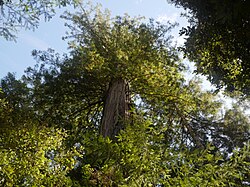
Mendocino Woodlands is a forest of coast redwoods, sprinkled with willow, alder, tanoak, and madrone trees. It is home to mountain lions (Puma concolor), Northern-spotted owls (Strix occidentalis caurina), and Cooper's hawks (Accipiter cooperii). Navarro river that runs through the park is used by salmon, river otters, and beavers.

Additionally, a wide variety of mushroom species grow alongside the redwoods, which are especially abundant during the rainy season. These include lobster mushroom (Hypomyces lactifluorium), red coral (Ramoria araiospora), and velvet-footed pax (Tapinella atritomentosa). [5] Pictured on the left is a fungus which can be found on hardwoods such as tanoak.
Management
The Mendocino Woodlands State Park is managed by Mendocino Woodlands Camp Association, a nonprofit corporation that has operated and maintained the facilities at the park since 1948.[3]
See also
References
- ^ "National Register Information System". National Register of Historic Places. National Park Service. January 23, 2007.
- ^ a b NHL Summary Archived 2007-03-18 at the Wayback Machine
- ^ a b Yumpu.com. "MENDOCINO WOODLANDS STATE PARK - Landscape Architecture". yumpu.com. Retrieved October 18, 2023.
- ^ a b Tramposch |, Bill (January 20, 2018). "Mendocino Woodlands: a National Historic Landmark built entirely with hand tools". The Ukiah Daily Journal. Retrieved October 18, 2023.
- ^ Siegel, Noah; Schwarz, Christian (August 9, 2016). Mushrooms of the Redwood Coast: A Comprehensive Guide to the Fungi of Coastal Northern California. Clarkson Potter/Ten Speed. ISBN 978-1-60774-818-2.
External links
Wikimedia Commons has media related to Mendocino Woodlands State Park.
- California State Parks official web page for Mendocino Woodlands
- Mendocino Woodlands Camp Association
- Wildernet: Mendocino Woodlands State Park
- Mendocino Woodlands Recreation Demonstration Area, National Historic Landmarks official page
- v
- t
- e
- List of U.S. National Historic Landmarks by state:
- Alabama
- Alaska
- Arizona
- Arkansas
- California
- Colorado
- Connecticut
- Delaware
- Florida
- Georgia
- Hawaii
- Idaho
- Illinois
- Indiana
- Iowa
- Kansas
- Kentucky
- Louisiana
- Maine
- Maryland
- Massachusetts
- Michigan
- Minnesota
- Mississippi
- Missouri
- Montana
- Nebraska
- Nevada
- New Hampshire
- New Jersey
- New Mexico
- New York
- North Carolina
- North Dakota
- Ohio
- Oklahoma
- Oregon
- Pennsylvania
- Rhode Island
- South Carolina
- South Dakota
- Tennessee
- Texas
- Utah
- Vermont
- Virginia
- Washington
- West Virginia
- Wisconsin
- Wyoming
 National Register of Historic Places portal
 Category


Municipalities and communities of Mendocino County, California, United States | ||
|---|---|---|
County seat: Ukiah | ||
| Cities |  | |
| CDPs | ||
| Unincorporated communities |
| |
| Indian reservations | ||
| Former settlements | ||
| Footnotes | ‡This populated place also has portions in an adjacent county or counties | |
| ||


