Rogue River–Siskiyou National Forest
United States forest in Oregon and California
42°03′45″N 123°56′15″W / 42.06250°N 123.93750°W / 42.06250; -123.93750The Rogue River–Siskiyou National Forest is a United States National Forest in the U.S. states of Oregon and California. The formerly separate Rogue River and Siskiyou National Forests were administratively combined in 2004. Now, the Rogue River–Siskiyou National Forest ranges from the crest of the Cascade Range west into the Siskiyou Mountains, covering almost 1.8 million acres (7,300 km2).[4] Forest headquarters are located in Medford, Oregon.

Geography
The former Rogue River portion of the Rogue River–Siskiyou National Forest is located in parts of five counties in southern Oregon and northern California. In descending order of land area they are Jackson, Klamath, Douglas, Siskiyou, and Josephine counties, with Siskiyou County being the only one in California. It has a land area of 628,443 acres (254,322 ha). There are local ranger district offices located in Ashland, Butte Falls, Grants Pass, Jacksonville, and Prospect.
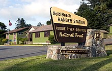
The former Siskiyou portion of the Rogue River–Siskiyou National Forest is located in parts of four counties in southwestern Oregon and northwestern California. In descending order of land area they are Curry, Josephine, and Coos counties in Oregon and Del Norte County in California. It has a land area of 1,094,726 acres (443,020 ha).[1] There are local ranger district offices located in Cave Junction, Gold Beach, and Powers.
Nearly all of the national forest is mountainous and includes parts of the Southern Oregon Coast Range, the Klamath Mountains, and the Cascade Range.
The largest river in the national forest is the Rogue River, which originates in the Cascade Range and flows through the Klamath Mountains and Coast Range. The Illinois River is a major tributary of the Rogue in the Klamath Mountains, while the Sixes, Elk, Pistol, Chetco, and Winchuck rivers drain the Coast Range directly to the Pacific Ocean.
Climate
| Climate data for Siskiyou National Forest (Southern Oregon and Northern California) | |||||||||||||
|---|---|---|---|---|---|---|---|---|---|---|---|---|---|
| Month | Jan | Feb | Mar | Apr | May | Jun | Jul | Aug | Sep | Oct | Nov | Dec | Year |
| Record high °F (°C) | 65 (18) | 80 (27) | 87 (31) | 96 (36) | 108 (42) | 111 (44) | 115 (46) | 115 (46) | 110 (43) | 100 (38) | 82 (28) | 69 (21) | 115 (46) |
| Mean daily maximum °F (°C) | 50 (10) | 55 (13) | 61 (16) | 68 (20) | 76 (24) | 84 (29) | 92 (33) | 92 (33) | 86 (30) | 74 (23) | 57 (14) | 49 (9) | 70 (21) |
| Mean daily minimum °F (°C) | 31 (−1) | 33 (1) | 35 (2) | 37 (3) | 41 (5) | 47 (8) | 51 (11) | 51 (11) | 46 (8) | 39 (4) | 36 (2) | 31 (−1) | 40 (4) |
| Record low °F (°C) | 6 (−14) | 6 (−14) | 21 (−6) | 22 (−6) | 22 (−6) | 27 (−3) | 28 (−2) | 30 (−1) | 24 (−4) | 18 (−8) | 10 (−12) | −2 (−19) | −2 (−19) |
| Average precipitation inches (mm) | 9.16 (233) | 8.56 (217) | 6.90 (175) | 3.04 (77) | 1.55 (39) | 0.66 (17) | 0.31 (7.9) | 0.54 (14) | 1.24 (31) | 3.11 (79) | 7.86 (200) | 8.79 (223) | 51.72 (1,312.9) |
| Average snowfall inches (cm) | 3.40 (8.6) | 1.70 (4.3) | 0.60 (1.5) | 0.30 (0.76) | 0 (0) | 0 (0) | 0 (0) | 0 (0) | 0 (0) | 0 (0) | 0.90 (2.3) | 3.60 (9.1) | 10.50 (26.7) |
| Source: [5] | |||||||||||||
History
The Siskiyou National Forest was established on October 5, 1906. On July 1, 1908, it absorbed Coquille National Forest and other lands. Rogue River National Forest traces its establishment back to the creation of the Ashland Forest Reserve on September 28, 1893, by the United States General Land Office. The lands were transferred to the Forest Service in 1906, and it became a National Forest on March 4, 1907. On July 1, 1908, Ashland was combined with other lands from Cascade, Klamath and Siskiyou National Forests to establish Crater National Forest. On July 18, 1915, part of Paulina National Forest was added, and on July 9, 1932, the name was changed to Rogue River.[6]
World War II bombing
On September 9, 1942, an airplane dropped bombs on Mount Emily in the Siskiyou National Forest, turned around, and flew back over the Pacific Ocean. The bombs exploded and started a fire, which was put out by several forest service employees. Bomb fragments were said to have Japanese markings. Stewart Holbrook vividly described this event in his essay "First Bomb".[7] It was later confirmed that the plane was indeed Japanese, and the incident became known as the Lookout Air Raids. It was the second bombing of the continental United States by an enemy aircraft, three months after the air attack by Japan on Dutch Harbor three months earlier on June 3–4.
Natural features

The national forest is home to some stands of old growth, including Port Orford cedar and Douglas fir in the Copper Salmon area.[8] A 1993 Forest Service study estimated that the extent of old growth in the forest was 345,300 acres (139,700 ha)[9] some of which occurs in the Red Buttes Wilderness. Blue oak, Quercus douglasii, and Canyon live oak, Quercus chrysolepis occur in the Siskiyou National Forest. For the California endemic Blue Oak, the disjunctive stands are occurring near the northern limit of its range, which occur no farther north than Del Norte County.[10] The world's tallest pine tree is a 268.35-foot (81.79 m) ponderosa and is located in the national forest.[11]
In 2002, the massive Biscuit Fire burned nearly 500,000 acres (200,000 ha), including much of the Kalmiopsis Wilderness.
Protected areas
The Rogue River–Siskiyou National Forest contains all or part of eight separate wilderness areas, which together add up to 565,900 acres (229,000 ha):[4]
- Copper Salmon Wilderness - 13,700 acres (55.4 km2)
- Grassy Knob Wilderness - 17,200 acres (69.6 km2)
- Kalmiopsis Wilderness - 179,775 acres (727.5 km2)
- Red Buttes Wilderness - 19,940 acres (80.7 km2)
- Rogue–Umpqua Divide Wilderness - 33,200 acres (134.4 km2)
- Siskiyou Wilderness - 152,680 acres (617.9 km2)
- Sky Lakes Wilderness - 113,590 acres (459.7 km2)
- Wild Rogue Wilderness - 35,818 acres (145.0 km2)
See also
References
- ^ a b "Table 6 - NFS Acreage by State, Congressional District and County". U.S. Forest Service. Retrieved September 30, 2007.
- ^ "Land Areas of the National Forest System" (PDF). U.S. Forest Service. January 2012. Retrieved June 30, 2012.
- ^ Revised Visitation Estimates (PDF) - U.S. Forest Service
- ^ a b "Rogue River–Siskiyou National Forest". U.S. Forest Service.
- ^ The Weather Channel: Monthly data for Siskiyou National Forest
- ^ Davis, Richard C. (September 29, 2005). "National Forests of the United States" (PDF). The Forest History Society. Archived from the original (PDF) on October 28, 2012.
- ^ "First Bomb" by Stewart Holbrook, The New Yorker, October 7, 1944
- ^ Copper Salmon Wilderness Campaign Archived 2009-02-25 at the Wayback Machine - Oregon Wild
- ^ Bolsinger, Charles L.; Waddell, Karen L. (1993). "Area of old-growth forests in California, Oregon, and Washington" (PDF). U.S. Forest Service, Pacific Northwest Research Station.
- ^ C. Michael Hogan (2008). Blue Oak: Quercus douglasii, GlobalTwitcher.com, ed. N. Stromberg Archived 2012-02-28 at the Wayback Machine
- ^ Fattig, Paul (January 23, 2011). "Tallest of the tall". Mail Tribune. Medford, Oregon. Retrieved January 27, 2011.
External links
 Media related to Rogue River-Siskiyou National Forest at Wikimedia Commons
- Rogue River–Siskiyou National Forest
- v
- t
- e
| |||||||||||||||||
National Forests and Grasslands | |||||||
|---|---|---|---|---|---|---|---|
| |||||||
|
| |||||||
| |||||||
|
|
- Heritage registers
- National Natural Landmarks
| |||||||||||||||||||||||||||||||
|---|---|---|---|---|---|---|---|---|---|---|---|---|---|---|---|---|---|---|---|---|---|---|---|---|---|---|---|---|---|---|---|
| Federal |
| ||||||||||||||||||||||||||||||
| State |
| ||||||||||||||||||||||||||||||
| Local |
| ||||||||||||||||||||||||||||||
| |||||||||||||||||||||||||||||||

Authority control databases | |
|---|---|
| International |
|
| National |
|


